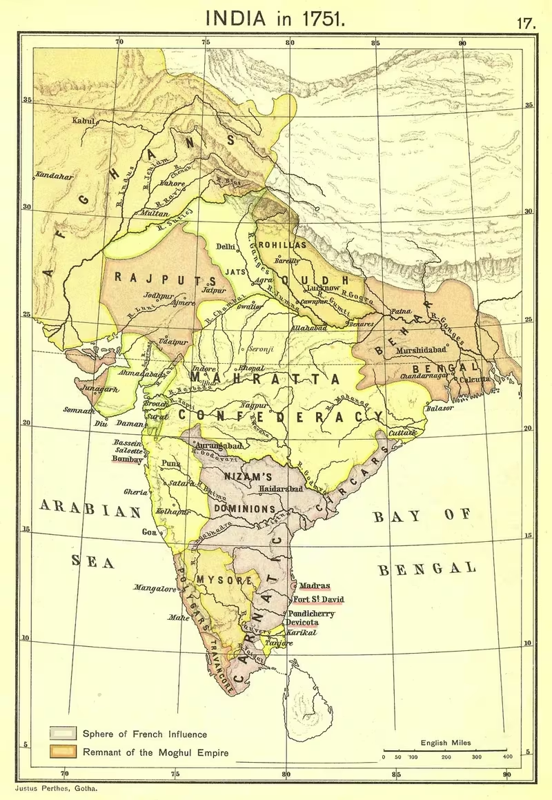
French India in 1816: A Map of Five Separated Enclaves
Introduction
In 1816, French India was not a continuous territory stretching across the subcontinent. It was a scattered chain of five establishments—Pondichéry, Karaikal, Yanam, Mahé and Chandernagore—located on different coastal zones and surrounded by territories under other powers. This fragmented geography is the defining feature of the map. Pondichéry and Karaikal lay on the Coromandel Coast, Yanam on the Andhra coast, Mahé on the Malabar Coast and Chandernagore in Bengal.
The year 1816 marks the restoration of these possessions to France after the Napoleonic Wars. The settlement included the five principal establishments and French lodges at places such as Machilipatnam, Kozhikode and Surat. Yet the restored territory represented only a limited colonial presence. In 1950, the total area of French India measured 510 square kilometres, of which 293 square kilometres belonged to Pondichéry. The population of the colony in 1936 was 298,851, with 63 percent living in the territory of Pondichéry.
This map therefore matters because it distinguishes between French commercial influence, military ambition and formal territorial possession. French officers and the French East India Company sometimes exercised influence over wider regions through alliances, treaties and military operations. That influence did not necessarily amount to annexation or sovereignty. The surviving political history supports a picture of coastal enclaves and intermittent influence rather than a durable French empire covering large parts of India.
Historical Context
France enters the Indian Ocean trade
France entered the East India trade later than England and the Netherlands. The English East India Company was founded in 1600 and the Dutch East India Company in 1602, while France still lacked a viable trading company or a permanent establishment in the East for several decades. Historians have associated this delay with France’s inland political centre, internal customs barriers and the limited interest of merchants on the Atlantic coast in the large investments required for distant Asian commerce.
A French commercial venture is believed to have taken place during the first half of the 16th century, during the reign of Francis I. Two ships fitted out by merchants from Rouen sailed from Le Havre towards the eastern seas and were never heard from again. A company received letters patent from Henry IV in 1604, but that project failed. Further letters patent were issued in 1615; two ships sailed to India, but only one returned.
The French East India Company, formally organised under the patronage of Cardinal Richelieu in 1642 and reconstructed under Jean-Baptiste Colbert in 1664, provided a more durable institutional basis for French activity. Its early goal was commercial. The company sought factories, ports and privileges rather than an immediate territorial empire.
The first factories
In 1667, an expedition commanded by François Caron, accompanied by a Persian named Marcara, reached Surat. In 1668, it established the first French factory in India. The following year Marcara established another French factory at Masulipatam on the Andhra coast.
French expansion remained vulnerable. In 1672, French forces captured Fort Saint Thomas, but the Dutch drove them out after a long and costly siege. The French acquired the area of Pondichéry in 1673 from the qiladar of Valikondapuram under the Sultan of Bijapur. This acquisition laid the foundation for the settlement that would become the centre of French India.
Chandernagore in Bengal was established in 1692 with the permission of Nawab Shaista Khan, the Mughal governor of Bengal. Pondichéry began its formal French administrative history on 4 February 1673, when the French officer Bellanger de l’Espinay took up residence in the Danish Lodge there. François Martin, the first governor, later worked to transform what had been a small fishing village into a port-town.
The French position remained unstable. The Dutch captured Pondichéry in 1693 and strengthened its fortifications. France regained the town through the Treaty of Ryswick, signed on 20 September 1697, with the transfer completed in 1699. By 1720, however, the French had lost their factories at Surat, Masulipatam and Bantam to the British East India Company.
The five-establishment configuration
Between 1723 and 1739, the French acquired the coastal locations that would later define the map of French India. Yanam was acquired in 1723 on the Andhra coast, approximately 840 kilometres north-east of Pondichéry. Mahé followed on the Malabar Coast in 1725. Karaikal, about 150 kilometres south of Pondichéry, was acquired in 1739.
During the early 18th century, Pondichéry expanded significantly. Governors Pierre Christophe Le Noir, who served from 1726 to 1735, and Pierre Benoît Dumas, who served from 1735 to 1741, enlarged the settlement and developed it into a large and wealthy town. Its layout followed a grid pattern. At this stage French objectives, like British objectives, were described as principally commercial.
Dupleix and the failed territorial ambition
The political character of French activity changed after Joseph François Dupleix became governor in 1741. Dupleix sought to establish a French territorial empire in India, despite the reluctance of his superiors and the French government to provoke Britain. His ambition led to military skirmishes and political intrigues with British interests.
Under the command of the Marquis de Bussy-Castelnau, French forces successfully controlled the area between Hyderabad and Cape Comorin for a period. This influence rested on military power, alliances and political arrangements. Later historical interpretations caution against treating it as a straightforward transfer of sovereignty. Alfred Martineau argued that the authority granted to Dupleix over the Carnatic in 1750 made him, in effect, a lieutenant of the Indian subah whose delegated power could be withdrawn. Philippe Haudrère similarly described the system as a complex network of treaties and alliances, guarded by French-commanded garrisons, rather than a set of annexed territories or formal protectorates.
Robert Clive’s arrival in India in 1744 helped undermine Dupleix’s plans. After military defeat and failed peace negotiations, Dupleix was dismissed and recalled to France in 1754.
War with Britain and contraction
French and British intrigues continued even when their governments were formally at peace. In Bengal, France encouraged Nawab Siraj ud-Daulah to attack and capture Fort William in Calcutta in 1756. The Battle of Plassey in 1757 ended in a decisive British victory over the Nawab and his French allies, extending British power across Bengal.
France then sent Lally-Tollendal to recover French possessions and drive the British from India. Lally reached Pondichéry in 1758 and initially achieved some success, including the destruction of Fort St. David in the Cuddalore district. Strategic mistakes later contributed to the loss of the Hyderabad region, defeat at the Battle of Wandiwash and the siege of Pondichéry in 1760.
The British captured Pondichéry in 1761 and razed it in retaliation for French depredations. The settlement remained in ruins for four years. France lost its hold in South India, and the political geography of French India became still more restricted.
Pondichéry was returned to France under the peace settlement of 1763, with the transfer taking place in 1765. Governor Jean Law de Lauriston began rebuilding the town on its former plan. Within five months, 200 European houses and 2,000 Tamil houses had been erected. The French East India Company was abolished by the French Crown in 1769 because it could not support itself financially; the Crown then assumed administration of the French possessions.
Pondichéry changed hands between France and Britain during subsequent wars and peace settlements. The fourth British occupation lasted from August 1803 until 26 September 1816. The restoration of the five establishments in 1816 created the configuration represented by this map.
Territorial Extent and Boundaries
French India had no single land frontier. Its territory consisted of enclaves separated by lands controlled by other Indian or European powers. The five principal establishments occupied four broad coastal settings:
- Coromandel Coast: Pondichéry and Karaikal.
- Andhra coast: Yanam.
- Malabar Coast: Mahé.
- Bengal: Chandernagore.
Pondichéry was the largest and most politically significant establishment. In later administrative descriptions, its territory included the districts of Pondichéry, Villenour and Bahour. Karaikal included dependent maganams, or districts. Yanam possessed dependent aldées, or villages. Mahé likewise included an associated territory.
The geographical separation of these possessions shaped their administration and strategic value. Pondichéry and Karaikal were comparatively close to one another on the Coromandel Coast, but Yanam lay far to the north-east, while Mahé was on the opposite, western coast of the peninsula. Chandernagore stood in Bengal, away from the southern French centres and north of Calcutta.
The 1816 restoration also involved French lodges. A lodge was a small factory or insulated establishment consisting of a house and adjacent ground where France retained the right to fly its flag and establish a trading post. The lodges did not create a continuous French territorial belt. Those associated with the restored French presence included locations at Machilipatnam, Kozhikode and Surat. A 19th-century list also records French lodges in Cassimbazar, Jougdia, Dacca, Balasore and Patna, as well as a Surat factory.
The French claims to several lodges were denied by the British after 1816, and the French did not reoccupy them. This distinction is essential when reading a map: a trading lodge, a factory and a formally administered establishment did not necessarily have the same legal or political status.
Administrative Structure
Pondichéry served as the administrative centre of French India. The governor resided there and was assisted by a council. During the period of the French East India Company, the senior official was generally styled Governor of Pondicherry and General Commander of the French Settlements in the East Indies. After 1816, the title became Governor of the French Establishments in India.
Administration was distributed between the central authority at Pondichéry and the individual establishments. Pondichéry itself comprised the districts of Pondichéry, Villenour and Bahour. Karaikal had its dependent districts, while Yanam and Mahé governed their associated territories. Chandernagore operated as the French establishment in Bengal, increasingly overshadowed by the growth of British Calcutta.
The legal structure included two tribunals of first instance, located at Pondichéry and Karaikal, one Court of Appeal at Pondichéry and five justices of the peace. This arrangement indicates a centralised judicial system with important functions concentrated in the principal settlement.
A decree of 25 January 1871 introduced an elective general council and elective local councils. The results were considered unsatisfactory, and both franchise qualifications and the classes eligible to vote were modified. The reform shows that French India was not merely a company trading zone by the late 19th century. It had become a formal colonial administration with representative institutions, although these institutions operated within a French imperial framework.
French India became an overseas territory of France in 1946. In 1947, after Indian independence, Charles François Marie Baron served as commissioner. Later commissioners administered the territory during negotiations and political transition. Following the Kizhoor referendum of 21 October 1954, Kewal Singh Choudhary became the first high commissioner under Indian authority.
Infrastructure and Communications
Pondichéry’s urban form was one of the clearest expressions of French administrative investment. The town was laid out on a grid pattern during the early 18th century and expanded under Le Noir and Dumas. After the destruction of 1761, Jean Law de Lauriston rebuilt it according to its earlier layout. The reconstruction of 200 European houses and 2,000 Tamil houses within five months demonstrates the concentration of administrative and construction activity in the settlement.
The available record does not describe a unified French road, postal or inland communications network linking the five enclaves. Their separation meant that maritime communication was especially important. Pondichéry, Karaikal, Yanam, Mahé and Chandernagore were all coastal or riverine trading locations, and the French presence depended on connections across the Indian Ocean and along India’s coastal trade routes.
The French East India Company’s network initially included Surat, Masulipatam and Bantam, although the first two were lost to the British East India Company by 1720. Later records mention trading connections or posts at Surat, Masulipatam, Calicut, Muscat, Mokha and Canton. These locations indicate a commercial geography extending beyond the five territorial establishments.
The map’s coastal emphasis should not be mistaken for evidence of uninterrupted French control over maritime routes. French ships and factories operated within a competitive environment dominated by rival European companies and shaped by Indian political authorities. The capture and recapture of Pondichéry, the Dutch siege of the town and repeated British occupations all show that ports and fortified settlements were exposed to wider naval and military conflicts.
Economic Geography
French activity in India began as a commercial enterprise. The first factories at Surat and Masulipatam were trading establishments, and Pondichéry itself developed from a small fishing village into a port-town. Chandernagore was established in Bengal with permission from the Mughal governor, showing that European commercial settlements depended on arrangements with Indian authorities.
The five establishments were economically diverse because they occupied different coastal regions. Pondichéry and Karaikal belonged to the Coromandel sphere, Yanam to the Andhra coast, Mahé to the Malabar Coast and Chandernagore to Bengal. Their locations gave France access to separate regional markets rather than a single integrated colonial economy.
Agricultural production in French India included rice, peanuts, tobacco, betel nuts and vegetables. The record does not provide a detailed production map or quantify the contribution of each establishment. It does, however, show that French India’s economy was not limited to overseas commerce. Agriculture supported the settlements and their dependent districts.
In 1950, Pondichéry accounted for 293 of the colony’s total 510 square kilometres. Its 1936 population was also the largest concentration in French India: 187,870 of the colony’s 298,851 inhabitants, or 63 percent, lived in the territory of Pondichéry. These figures underline the demographic and territorial importance of Pondichéry within an otherwise dispersed colonial system.
Trading lodges had a narrower role. Their function was connected to the right to maintain a factory, a residence and adjacent ground for commerce. They were not equivalent to broad territorial possessions. This distinction helps explain why French India could retain a visible commercial presence in cities such as Surat, Calicut and Masulipatam without controlling the surrounding regions.
Cultural and Religious Geography
French India brought together several regional societies rather than a single cultural zone. Pondichéry and Karaikal were located in Tamil-speaking areas of the Coromandel Coast; Yanam was situated on the Andhra coast; Mahé on the Malabar Coast; and Chandernagore in Bengal. The map therefore represents a multilingual and regionally varied colonial presence.
The reconstruction of Pondichéry included both European and Tamil houses. The figures recorded for the rebuilding—200 European houses and 2,000 Tamil houses—indicate the coexistence of French colonial institutions and an established Tamil urban population. The description of Pondichéry as a large and rich town under its 18th-century governors also points to the settlement’s role as a centre of administration, commerce and cultural interaction.
The record identifies Catholic missions and the Apostolic Prefecture of French Colonies in India among the institutions associated with French India. It also connects French India with the Paris Foreign Missions Society. These institutions formed part of the religious geography of French colonial rule, although the surviving account does not quantify the spread of Christianity or map religious communities across each enclave.
French India’s cultural influence should likewise be separated from territorial authority. French education, law and administration were among the fields that successive governors attempted to develop after 1816. These efforts produced a distinctive colonial institutional legacy, particularly in Pondichéry, but they did not erase the regional identities of Tamil, Telugu, Malayalam and Bengali societies surrounding the enclaves.
Military Geography
The military geography of French India centred on fortified ports and politically strategic settlements. Pondichéry was the principal stronghold. Its capture by the Dutch in 1693, return to France through the Treaty of Ryswick and destruction by the British in 1761 demonstrate its strategic importance.
Fort Saint Thomas was another early French objective. French forces captured it in 1672 but lost it to the Dutch after a long siege. Fort St. David near Cuddalore was destroyed during Lally-Tollendal’s campaign in 1758. These actions show how French military operations were directed towards coastal forts and British positions rather than toward the creation of a single continuous territorial frontier.
The period of Dupleix’s ascendancy connected French military geography to the politics of the Deccan and the Carnatic. Under Marquis de Bussy-Castelnau, French forces controlled the area between Hyderabad and Cape Comorin for a time. That control depended on alliances, treaties and French-commanded garrisons. It was therefore powerful but politically conditional.
The decisive reversals came through a series of conflicts. The Battle of Plassey in 1757 weakened French influence in Bengal after the defeat of Siraj ud-Daulah and his French allies. In the south, the Battle of Wandiwash and the siege of Pondichéry in 1760 ended French hopes of dominating the region. The British occupation and demolition of Pondichéry in 1761 marked the collapse of France’s military position in South India.
After the 1763 peace settlement and the later return of Pondichéry, French possessions were repeatedly exposed to Anglo-French wars. The British occupations listed in the administrative chronology include periods beginning in 1761, 1778, 1793 and 1803. The fourth occupation ended in 1816, when the five establishments were restored. Their later existence depended less on independent military expansion than on diplomatic agreements between France and Britain and, after 1947, negotiations with India.
Political Geography
French India’s political geography was defined by relationships with Indian rulers and rival European powers. Pondichéry was acquired from the qiladar of Valikondapuram under the Sultan of Bijapur. Chandernagore was established with permission from Nawab Shaista Khan, the Mughal governor of Bengal. These episodes demonstrate that French settlements were created through negotiated authority rather than by unilateral conquest alone.
During the early period, France competed with the Dutch and British East India Companies. The Dutch seizure of Pondichéry and Fort Saint Thomas exposed the vulnerability of French settlements. The loss of factories at Surat and Masulipatam to the British East India Company by 1720 further reduced the French commercial network.
From the 1740s, French political intervention intensified. Dupleix sought influence at Indian courts, while Bussy’s forces operated between Hyderabad and Cape Comorin. The French supported Siraj ud-Daulah in Bengal in 1756, contributing to the crisis that led to Plassey. These relationships were strategic and changing rather than evidence of permanent French sovereignty over all territories where French officers or allies were active.
The post-1816 map should consequently be read alongside the distinction between establishments, lodges and spheres of influence. France possessed five principal enclaves. It had claims or trading rights in additional locations, but British opposition prevented the reoccupation of several lodges. The political geography was therefore one of limited, legally defined possessions surrounded by British India and other regional jurisdictions.
Legacy and Decline
The 1816 configuration lasted until the process of decolonisation after Indian independence. The lodges at Machilipatnam, Kozhikode and Surat were ceded to India on 6 October 1947. An agreement between France and India in 1948 provided for elections in the remaining French possessions to determine their political future.
Chandernagore was ceded to India on 2 May 1950 and merged with West Bengal on 2 October 1954. The four southern and western enclaves—Pondichéry, Yanam, Mahé and Karaikal—were transferred de facto to the Indian Union on 1 November 1954 and became the Union Territory of Puducherry.
The legal transfer took longer. The de jure union of French India with India was completed in 1962, when the French Parliament in Paris ratified the treaty with India. French rule thus ended through a staged process involving cession, political consultation, de facto transfer and later legal ratification.
The history of French India also left behind a powerful historical myth. From the mid-19th century, some French writers and colonial advocates described the five settlements as remnants of an immense empire created by Dupleix. Later descriptions called them the “debris” or final remnants of a lost empire. Historians of French India have challenged this interpretation. Dupleix exercised significant influence, but the territories under his command were generally held through alliances, delegated authority and garrisons rather than through complete annexation.
The map of French India in 1816 therefore offers a corrective to the image of a vanished French empire covering much of India. It shows a smaller and more precise reality: five separated coastal establishments, a handful of contested trading lodges and a colonial administration centred on Pondichéry. Their importance lay not in territorial continuity but in the way commerce, diplomacy, military competition and colonial law intersected across the Indian subcontinent.