Khandesh Sultanate and the Farooqi Dynasty, 1382–1601
Introduction
The Farooqi history of Khandesh begins at Thalner, a settlement on the Tapti River where Malik Ahmad, later known as Malik Raja, established his power after fleeing political conflict in the Deccan. From this base, he transformed a regional fief into an independent sultanate. By 1382, the Farooqi dynasty ruled Khandesh independently; by 1601, its last stronghold, Asirgarh, had fallen to the Mughal emperor Akbar.
This map follows the changing political geography of Khandesh across more than two centuries. It places Thalner, Asirgarh, Burhanpur, and Laling within the sequence of Farooqi expansion, rivalry, and submission. It also shows how the sultanate’s position between Gujarat, Malwa, Berar, Ahmadnagar, Gondwana, and the Mughal Empire made it a contested frontier rather than an isolated regional kingdom.
The dates of several events vary in the historical record. In particular, the chronicle associated with Ferishta gives alternative dates for the deaths of some Farooqi rulers. The broad political sequence, however, remains clear: independence under Malik Raja, consolidation under Nasir Khan, prominence under Adil Khan II, increasing pressure from neighbouring sultanates, and final annexation under Akbar.
Historical Context
Malik Raja’s rise followed a failed rebellion against the Bahmani ruler Muhammad Shah I. In 1365, Malik Raja and other chiefs from Berar and Baglana joined a revolt led by Bahram Khan Mazindarani, the governor of Daulatabad. After the rebellion failed, Malik Raja fled the Deccan and settled at Thalner.
His fortunes changed after he assisted Firuz Shah Tughluq during a hunting expedition in Gujarat. He was first appointed an officer commanding two thousand horses. In 1370, he received the fiefs of Thalner and Karanda, identified with present-day Karwand, approximately 19 kilometres north of Thalner. In the same period he defeated the Raja of Baglana, secured an agreement for annual tribute, received the title Sipah-salar, and was raised to the command of three thousand horses.
Malik Raja expanded his military following and was eventually able to muster twelve thousand horses and collect contributions from neighbouring rulers. By 1382, he had ceased to be merely a local officer and ruled Khandesh as an independent sovereign. The early sultanate was not yet a densely urbanized state. The region is described as having been inhabited by Bhils and Kolis, while Asirgarh was associated with a prosperous Ahir population. Malik Raja’s early government therefore included measures to develop agriculture alongside military expansion.
His first major territorial advance took him toward Gujarat. He annexed Sultanpur and Nandurbar, but the Gujarat governor Zafar Khan, later Muzaffar Shah, responded by besieging Thalner. Malik Raja was compelled to restore the territories he had taken. The episode established a recurring pattern in Khandesh history: the sultanate could expand into neighbouring regions, but Gujarat, Malwa, Ahmadnagar, Berar, and later the Mughals could intervene whenever Khandesh threatened the regional balance.
Nasir Khan succeeded Malik Raja in 1399. He initially ruled from Laling because Thalner was controlled by his younger brother, Malik Iftikar Hasan. In 1400, Nasir Khan captured Asirgarh, killed its Hindu ruler, and made the fort his capital. He later founded Burhanpur in 1399, which became the principal political and commercial centre of Khandesh.
The struggle for Thalner continued. In 1417, Nasir Khan secured assistance from Hoshang Shah of Malwa, captured the fort, and imprisoned his brother. A subsequent campaign against Gujarat resulted in the occupation of Sultanpur, but Gujarat forces recovered the initiative. Nasir Khan eventually swore fealty to the Gujarat sultan and received the title Khan.
His later reign included conflict with the Bahmani state. In 1435, supported by the Raja of Gondwana and dissatisfied Bahmani officials, Nasir Khan attacked and captured Berar. The Bahmani general Malik-ut-Tujjar defeated him at Rohankhedaghat, pursued him to Burhanpur, ransacked the city, and defeated his remaining army at Laling. Nasir Khan died soon afterwards in 1437.
The middle Farooqi period was marked by closer relations with Gujarat and limited territorial ambitions. Miran Adil Khan I accepted Gujarat’s suzerainty and was probably assassinated at Burhanpur in 1441. Miran Mubarak Khan I undertook two campaigns against Baglana but did not pursue a major programme of conquest.
A renewed expansion occurred under Miran Adil Khan II, who succeeded in 1457. He fortified Asirgarh and built the citadel of Burhanpur. His campaigns reached the territories of the Gond rulers of Gondwana and Mandla and extended toward Jharkhand. He adopted the title Shah-i-Jharkhand, signalling the scale of his claims. He also stopped paying tribute to Gujarat, but a Gujarat army entered Khandesh in 1498 and forced him to pay arrears. His reign ended with his death in 1501.
Territorial Extent and Boundaries
The political boundaries of Khandesh changed repeatedly, and the surviving record does not establish one uniform frontier for the entire Farooqi period. The stable heartland lay around the Tapti valley, with Thalner, Asirgarh, and Burhanpur serving as the most important points in the political landscape. The map therefore distinguishes between the Farooqi core and areas that were temporarily conquered, compelled to pay tribute, or brought under outside suzerainty.
The western and north-western frontier faced Gujarat. Sultanpur and Nandurbar were repeatedly contested. Malik Raja briefly annexed both, only to return them after Zafar Khan’s intervention. Later rulers again fought Gujarat over Nandurbar, Thalner, and the succession politics of neighbouring states.
The southern and south-eastern frontier connected Khandesh with the Bahmani successor states, especially Ahmadnagar and Berar. Nasir Khan’s attack on Berar in 1435 ended in a severe Bahmani counterattack. During the sixteenth century, Farooqi rulers alternately cooperated with and opposed Ahmadnagar. Khandesh could support a claimant in Berar, shelter a displaced ruler, or become the route through which an Ahmadnagar army entered the Tapti region.
The eastern and south-eastern political horizon included Gondwana and Mandla. Malik Raja received tribute from the Gond Raja of Mandla, while Adil Khan II is described as having overpowered the Gond rulers of Gondwana and Mandla. These relationships appear to have involved tribute and military dominance rather than a clearly defined system of direct provincial administration.
Malwa formed another important frontier. Hoshang Shah assisted Nasir Khan in the capture of Thalner, while later Farooqi rulers participated in Malwa campaigns. After Baz Bahadur was defeated by Akbar in 1561, he took refuge in Khandesh. The Mughal general Pir Muhammad Khan pursued him, devastated the kingdom, and occupied Burhanpur temporarily. A joint Khandesh–Berar force later defeated Pir Muhammad Khan, recovered Malwa, and restored Baz Bahadur.
By the late sixteenth century, the most consequential frontier was the Mughal one. Raja Ali Khan accepted Mughal subordination in 1577 and later agreed to recognize Mughal suzerainty after a diplomatic mission in 1591. His successor, Bahadur Shah, resisted closer cooperation and prepared Asirgarh for war. Akbar occupied Burhanpur in 1599, and Asirgarh fell on January 17, 1601.
Administrative Structure
The Farooqi state developed from military appointments and fiefs rather than from a fully documented bureaucratic scheme. Malik Raja’s authority began with the fiefs of Thalner and Karanda, expanded through conquest, and became independent rule in 1382. His political power rested on military command, tribute from neighbouring rulers, and the ability to secure agricultural production in the Khandesh heartland.
The capitals shifted according to political and strategic need. Thalner was Malik Raja’s base and remained an important dynastic centre. Nasir Khan began his reign from Laling while his brother held Thalner. After capturing Asirgarh, he made it his capital, before establishing Burhanpur as the new capital in 1399. Asirgarh remained the principal defensive stronghold, while Burhanpur developed into the centre of government, commerce, and textile production.
The record shows a combination of direct rule and subordinate relationships. Some territories were annexed temporarily, such as Sultanpur and Nandurbar under Malik Raja. Other rulers, including the Raja of Baglana and the Gond rulers of Mandla, were compelled to pay tribute. At various points the Farooqi sultans themselves accepted the suzerainty of Gujarat, Malwa, or the Mughals.
Court factions were also central to administration. Daud Khan depended on the brothers Hussain Ali and Yar Ali, with Hussain Ali serving as wazir. His political influence contributed to the decision to attack Ahmadnagar. Later succession crises involved nobles, rival Farooqi claimants, and intervention by Gujarat, Ahmadnagar, and Berar.
Under Mughal control, Khandesh became a Mughal subah. Prince Daniyal was appointed its viceroy after the annexation, while Abul Fazl was appointed governor during the final campaign.
Infrastructure and Communications
The historical record does not provide a detailed description of roads, postal stations, bridges, or a formal communication system in Khandesh. It does, however, reveal the importance of river settlements, forts, capitals, and military corridors.
The Tapti River was central to the geography of the early sultanate. Malik Raja established himself at Thalner on the river, and the settlement served as the dynastic burial place for several early rulers. The movement between Thalner, Laling, Asirgarh, and Burhanpur reflects a political network linking the river valley with fortified uplands.
Burhanpur’s growth under Adil Khan II indicates the development of urban infrastructure sufficient to support trade and textile production. The citadel of Burhanpur and the fortifications of Asirgarh were especially important. Their construction and reinforcement enabled the Farooqi rulers to protect the capital and control approaches into Khandesh.
Military movements also identify the principal communication routes of the period. Gujarat armies advanced toward Sultanpur and Thalner. Bahmani forces moved through Rohankhedaghat, Burhanpur, and Laling. Ahmadnagar armies entered Khandesh and followed Farooqi forces toward Asirgarh. Mughal forces occupied Burhanpur before investing Asirgarh. These movements show that the sultanate’s geography was organized around access corridors between Gujarat, Malwa, Berar, Ahmadnagar, and the Tapti valley.
There is no evidence in the record for Farooqi maritime power. Khandesh was an inland sultanate, and its economic connections were conducted through overland routes and regional political networks.
Economic Geography
Agriculture was an early concern of Malik Raja’s government. The account of his reign describes Khandesh as a relatively backward region at the time of his accession and notes that he took steps to develop agriculture. This policy was important because the sultanate’s military strength depended on revenue from its settled territory and tribute from surrounding rulers.
The Tapti valley formed the economic core of the kingdom. Thalner’s location on the river made it a suitable early base, while Burhanpur later became the major urban centre. Under Adil Khan II, Burhanpur was transformed into a prominent centre for trade and textile production. The city’s commercial importance strengthened its role as the capital and made its occupation strategically valuable to rival powers.
The record names Sultanpur and Nandurbar as contested centres on the western side of the sultanate. Their repeated occupation and recovery suggest that they were important to the political and economic connections between Khandesh and Gujarat. The tribute extracted from Baglana and the Gond territories also formed part of the sultanate’s wider economic geography.
No detailed catalogue of commodities, market institutions, tax rates, or merchant communities survives in the account considered here. The evidence is strongest for agriculture, textiles, tribute, and the strategic importance of Burhanpur rather than for a complete reconstruction of the region’s commercial economy.
Cultural and Religious Geography
Malik Raja claimed descent from Umar al-Faruq, the second caliph, and the dynasty took the name Faruqi or Farooqi from this genealogical claim. The dynasty’s remembered ancestry connected it to a family associated with Khorasan and to migration through Uch and Delhi after the conquest of Balkh by Genghis Khan in 1220. These traditions formed part of the dynasty’s political identity.
The ruling family’s history was also connected to the Delhi Sultanate. Malik Raja’s father, Khan-i-Jahan or Khwaja-i-Jahan Faruqi, served as a minister in the Delhi court. Members of the family were described as prominent nobles under Ala-ud-Din Khalji and Muhammad bin Tughluq before Malik Raja’s move into the Deccan.
Khandesh was not a culturally uniform territory. The early account refers to Bhils and Kolis in the wider region and to Ahirs around prosperous Asirgarh. The Farooqi state therefore governed a population composed of different local communities while operating through an Islamic sultanate founded by a military aristocracy.
The record identifies Thalner as the burial place of Malik Raja, Nasir Khan, Miran Adil Khan I, and Miran Mubarak Khan I. Adil Khan II was buried near his palace in Burhanpur, while Raja Ali Khan’s body was returned to Burhanpur after his death in battle. These burial sites show the dynastic importance of both Thalner and Burhanpur.
The available account does not provide a systematic description of language distribution, religious institutions, temples, mosques, or the spread of particular schools of Islamic thought. It does, however, show a political culture in which Islamic royal titles, dynastic genealogies, local ruling houses, and tribute relationships existed together.
Military Geography
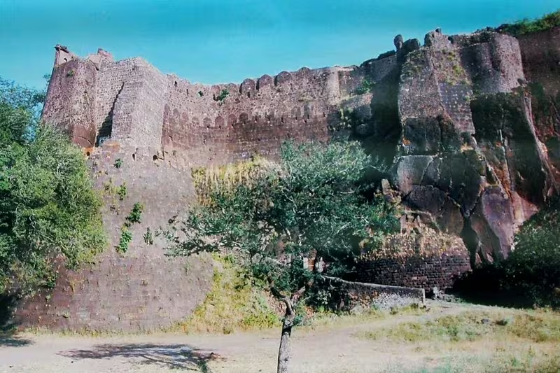
Asirgarh was the decisive military landmark of Khandesh. Nasir Khan captured the fort in 1400 and made it his capital before the rise of Burhanpur. Adil Khan II later strengthened Asirgarh and built the citadel of Burhanpur. The fort’s position made it the final defensive barrier of the Farooqi state.
Thalner was both a political centre and a contested fortress. Nasir Khan’s conflict with his brother led to the capture of Thalner in 1417 with Malwa’s assistance. Gujarat later besieged the fort, forcing Nasir Khan to recognize Gujarat’s authority. The struggle demonstrates how control of Thalner could determine the political alignment of Khandesh.
The sultanate’s armies included mounted forces. Malik Raja’s rise is associated with commands of two thousand and three thousand horses, eventually increasing to a force of twelve thousand horses. These figures belong to the account of his military career and should not be treated as a complete census of the Farooqi army.
Major campaigns included Nasir Khan’s conquest of Asirgarh, his attack on Berar, the Bahmani counterattack through Rohankhedaghat and Laling, Adil Khan II’s campaigns toward Gondwana, Mandla, and Jharkhand, and the repeated wars with Gujarat and Ahmadnagar. In the sixteenth century, Khandesh participated in the restoration of Baz Bahadur after defeating the Mughal general Pir Muhammad Khan.
Raja Ali Khan fought on the Mughal side at Sonpet in 1597 and died there. His successor, Bahadur Shah, adopted a different strategy. He avoided joining the Mughal army in person, refused to meet Prince Daniyal at Burhanpur in 1599, and withdrew to Asirgarh. Akbar reached Burhanpur on April 8, 1599. Abdur Rahim Khan-i-Khanan conducted the siege of Asirgarh, while Abul Fazl was appointed governor of Khandesh. Bahadur Shah surrendered on December 10, 1600, but the fort continued to resist under his general Yakut Khan until January 17, 1601.
Political Geography
Khandesh occupied a zone of interaction among several powerful states. Gujarat was its most persistent western rival and at times its suzerain. Malwa provided military assistance to Nasir Khan and later became connected to Khandesh through the refuge given to Baz Bahadur. Ahmadnagar and Berar alternated between alliance, intervention, and direct military pressure. Gondwana and Mandla appear in the record as tributary or subordinate powers during periods of Farooqi expansion.
Marriage also supported diplomacy. In 1429, Nasir Khan married his daughter to the Bahmani prince Ala-ud-Din, later Ahmad Shah II. In the same year, Raja Kanha of Jhalawar sought refuge at Asirgarh and later travelled to Bidar to request Bahmani assistance.
The sixteenth century brought increasingly direct Mughal involvement. Akbar’s expedition in 1577 compelled Raja Ali Khan to accept subordination. In 1591, Raja Ali Khan agreed to accept Mughal suzerainty after a diplomatic mission led by Faizi. He was later granted a mansab of five thousand. His death while fighting alongside the Mughals at Sonpet illustrates the transitional status of Khandesh: formally ruled by its own dynasty, but increasingly integrated into Mughal political structures.
Bahadur Shah’s refusal to cooperate with the Mughals ended this negotiated relationship. The fall of Asirgarh converted Khandesh from a regional sultanate into a Mughal subah.
Legacy and Decline
The Farooqi dynasty ruled Khandesh independently from 1382 until 1601. Its political centre moved from Thalner to Asirgarh and then to Burhanpur, reflecting the changing relationship between riverine settlement, fortified upland, and commercial capital.
The dynasty’s decline was gradual rather than sudden. It was weakened by succession disputes, dependence on powerful nobles, tribute obligations, military defeats, and pressure from Gujarat, Ahmadnagar, Berar, Malwa, and the Mughals. Yet the Farooqi state remained resilient for more than two centuries. Burhanpur’s development as a trade and textile centre and the continued importance of Asirgarh ensured that Khandesh retained regional significance even as its independence narrowed.
The final sequence was decisive. Akbar’s forces occupied Burhanpur in 1599. Bahadur Shah surrendered in December 1600, but Asirgarh held out until January 17, 1601. Khandesh was then annexed to the Mughal Empire, and Prince Daniyal became viceroy of the new Mughal subah.
The map’s central lesson is geographical: Khandesh’s history was shaped by the relationship between the Tapti valley, fortified centres, and the rival political worlds surrounding it. Thalner founded the Farooqi story, Burhanpur gave the sultanate commercial and administrative weight, and Asirgarh prolonged its final resistance. Together, these places explain how a regional dynasty survived between larger powers—and why its eventual conquest mattered to the Mughal expansion into the Deccan.