Maitraka Kingdom of Valabhi, c. 640 CE
Introduction
Valabhi, on the western coast of India, was the political and intellectual centre of the Maitraka Kingdom from approximately 475 to 776 CE. Founded by the military governor Bhaṭārka after the weakening of Gupta authority, the dynasty established a durable regional power in Saurashtra. This map places Valabhi at the heart of a kingdom whose recorded connections extended into north Gujarat and, during the reign of Kharagraha I, as far as Ujjain.
The seventh century is especially significant because Maitraka power combined political autonomy with cultural influence. The dynasty came under the authority of Harṣa of the Vardhana dynasty in the middle of that century but retained local autonomy and regained independence after Harṣa’s death. Valabhi was also a major centre of Buddhist, Jain, Brahmanical, and secular learning. The map therefore shows not only a territorial formation but also a coastal kingdom connected to wider intellectual and religious networks.
Historical Context
Bhaṭārka had served as a Gupta military governor in Saurashtra before establishing himself as an independent ruler around 475 CE. The first two Maitraka rulers, Bhaṭārka and Dharasena I, used the title Senapati, or general. Their successor Droṇasiṁha adopted the title Maharaja, marking a clearer assertion of royal status.
During the reign of Dhruvasena I, a Jain council was probably held at Vallabhi. Dharapaṭṭa, the fifth ruler, is the only Maitraka king specifically associated with sun-worship. The wider dynasty was predominantly Shaiva, although Vaishnavism, Buddhism, Jainism, and goddess worship were also present under Maitraka rule.
Guhasena discontinued the formula Paramabhattaraka Padanudhyata, traditionally interpreted as signalling nominal allegiance to Gupta overlords. His successor Dharasena II used the title Mahadhiraja. Śilāditya I Dharmāditya, who ruled in the seventh century, was praised by the Chinese traveller Hiuen Tsang, who visited in 640 CE, as a ruler of unusual administrative ability, kindness, and compassion.
Kharagraha I followed Śilāditya I. His Virdi copperplate grant, dated 616 CE, records territory that included Ujjain. Under Dharasena III, north Gujarat was incorporated into the kingdom. Dhruvasena II, also known as Balāditya, married a daughter of Harṣavardhana. Later, Dharasena IV adopted the imperial titles Paramabhattaraka Maharajadhiraja Parameshvara Chakravartin. Sanskrit poet Bhatti was associated with his court.
Territorial Extent and Boundaries
The Maitraka heartland was Saurashtra, with Valabhi serving as the capital. The kingdom occupied a strategically placed region beside the Arabian Sea, although the surviving record does not provide a single, fixed boundary for every stage of Maitraka rule.
To the north, the kingdom included parts of Gujarat. North Gujarat is specifically associated with the reign of Dharasena III. The eastern extent is harder to define, but the 616 CE grant of Kharagraha I connects Maitraka authority with Ujjain. This indicates a political reach beyond the Saurashtra peninsula into western-central India.
The western and southern edges were shaped by the Arabian Sea and the coastal lands of Saurashtra. The exact inland frontier, however, changed over time and cannot be reconstructed with certainty from the available inscriptions. The map therefore distinguishes the Maitraka core from regions documented at particular moments rather than presenting every frontier as permanently fixed.
No securely identified tributary states are recorded in the available evidence. Likewise, the record does not establish a complete list of provinces or directly administered districts. The map’s territorial reconstruction should consequently be read as a historical approximation based on royal grants, political references, and descriptions of the kingdom.
Administrative Structure
Valabhi was the seat of the Maitraka kings and the principal centre of administration. The changing titles of the rulers reveal the dynasty’s political development: from military leadership under the early Senapatis to royal and eventually imperial claims under later monarchs.
Copperplate grants are important evidence for administration and territorial authority. They record royal acts and help connect particular rulers with specific areas, including Ujjain and north Gujarat. Yet these documents do not provide a complete administrative survey of the kingdom. The division of the realm into provinces, the precise responsibilities of local officials, and the relationship between the capital and rural authorities remain incompletely known.
Valabhi’s importance extended beyond government. It was a university town whose graduates were reportedly appointed to high executive positions. This suggests a connection between advanced education and administrative service, although the surviving accounts do not describe a standardized bureaucratic system.
Infrastructure and Communications
Detailed evidence for Maitraka roads, postal arrangements, or formal communication systems is not preserved in the historical record used here. The kingdom’s geography nevertheless placed it within the coastal and overland corridors of western India. Valabhi’s position in Saurashtra connected the capital to the Arabian Sea, Gujarat, and routes leading toward Ujjain.
The dynasty’s maritime environment also exposed it to attacks from the sea. Repeated Arab attacks weakened the kingdom considerably, especially toward the end of the Maitraka period. The evidence confirms the strategic importance of the coast but does not describe a formal Maitraka navy or identify particular harbours and naval bases.
Economic Geography
The available record does not list specific commodities, taxation systems, agricultural zones, or market regulations. It does, however, identify Valabhi as a major urban and educational centre and places the kingdom in a region with both coastal and inland connections.
Saurashtra’s maritime position gave the Maitraka realm access to the Arabian Sea, while control or influence in north Gujarat and around Ujjain connected it to the interior. These links likely supported movement of people, ideas, and goods, but the precise structure of Maitraka trade cannot be established from the surviving evidence. No securely documented list of major ports or commercial products is available for this map.
Cultural and Religious Geography
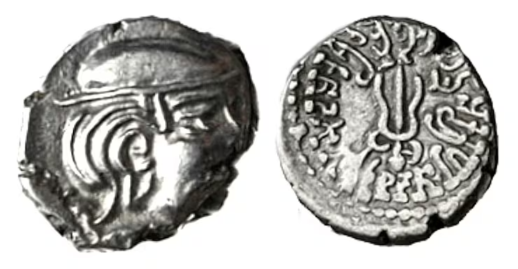
Maitraka religious life was diverse. Most rulers were Shaivas and used the title Parama-maheshwara. Coins and inscriptions employed symbols such as Nandi, the bull associated with Shiva, and the trident. Dhruvasena I is described as Vaishnava in one account, while Dharapaṭṭa is associated with sun-worship.
Buddhist viharas existed throughout the kingdom. When the Chinese traveller I-Tsing visited Valabhi in the last quarter of the seventh century, he described it as a great centre of learning that included Buddhism. The Buddhist scholars Gunamati and Sthiramati were associated with Valabhi during the middle of the seventh century.
Jainism also held an important place. A Jain council was probably convened at Valabhi during the reign of Dhruvasena I. The Maitrakas made grants and donations to different religious communities, indicating a policy of broad religious tolerance. More than one hundred temples associated with this period are known, especially along the western coast of Saurashtra.
Military Geography
The dynasty emerged from a military background. Bhaṭārka had been a Gupta general, and early Maitraka rulers retained the title Senapati. The kingdom’s position on the western coast brought both opportunity and danger. Its coastal access supported wider connections but also exposed it to repeated Arab attacks by sea.
The available evidence does not identify specific battles, army sizes, fortresses, or permanent military divisions. It does show that the Maitrakas were capable of establishing independence after the decline of Gupta power and of maintaining authority across a territory that included Saurashtra, north Gujarat, and, at least temporarily, Ujjain.
Political Geography
The Maitrakas inherited a political environment shaped by the decline of the Gupta Empire. Their early connection with Gupta administration was gradually replaced by independent rule. In the mid-seventh century, they came under Harṣa’s authority while retaining local autonomy. After Harṣa’s death, they recovered their independence.
Marriage also linked the dynasty to wider north Indian politics: Dhruvasena II married a daughter of Harṣavardhana. This relationship indicates diplomatic importance beyond the immediate Saurashtra region, although the precise political terms of the marriage are not recorded here.
Legacy and Decline
Maitraka rule continued for roughly three centuries, from approximately 475 until the late eighth century. Arab attacks from the sea weakened the kingdom, and the dynasty ended by about 783 CE. Legendary accounts connect the fall of Vallabhi with Tajjika, or Arab, invasions, but no historical account securely explains the exact circumstances of the dynasty’s end.
The Maitraka legacy survives in the memory of Valabhi as a capital, university, and religious centre. Its inscriptions illuminate the transition from Gupta-era provincial authority to regional kingship, while its temples, educational institutions, and plural religious traditions mark Saurashtra as a major centre of western Indian history.