Western Satraps at the Height of Rudradaman I, c. 150 CE
Introduction
From the Saurashtra peninsula and the markets of Gujarat to Malwa, Sindh, and the western Deccan, the Western Satraps controlled or claimed a broad belt of western and central India during the second century CE. This map focuses on the reign of Rudradaman I, conventionally dated to approximately 130–150 CE, when the dynasty recovered much of the territory previously associated with Nahapana and confronted both the Satavahanas and the Yaudheyas.
The political geography of this period cannot be represented as a perfectly fixed modern border. The Junagadh rock inscription presents an extensive royal claim, while inscriptions, coins, and later discoveries show that authority varied from region to region. Some areas were directly governed, some were contested, and some may have been connected through subordinate rulers or changing alliances. The map therefore distinguishes the broad Satrap realm from frontier and control zones that remain uncertain.
The term “Western Satraps” is a modern historical designation. The rulers called themselves Kshatrapa and Mahakshatrapa, titles derived from the wider political vocabulary of satrapal government. Indian records also identify them as Sakas, while the second-century geographer Ptolemy describes them as Indo-Scythians. They were contemporaries of the Kushans in the north and the Satavahanas in central and southern India.
Historical Context
Saka rule in western India
The Western Satraps emerged from Indo-Scythian political formations that became established in western and central India during the first centuries BCE and CE. The earliest phase is associated with the Kshaharata dynasty. Abhiraka is known from rare coins, while Bhumaka used the title Satrap and is identified as the father of Nahapana.
Nahapana transformed the Kshaharata kingdom into a powerful western Indian state. His authority extended across parts of Malwa, southern Gujarat, northern Konkan, and the districts around Nasik and Poona. Bharukachchha, the port identified with Barygaza or Barigaza in Greek and Roman accounts, lay within the commercial world of this kingdom. Nahapana also established a silver coinage that became a defining feature of Western Satrap monetary practice.
The exact dating of Nahapana remains debated. His reign has been placed in different chronological ranges, including the first and early second centuries CE. Coins and inscriptions establish his political importance, but the surviving evidence does not produce a single uncontested dating scheme.
Ushavadata and the southern territories
Nahapana's son-in-law Ushavadata acted as a viceroy in the southern part of his territory. Inscriptions at Nasik, Karla, and Junnar associate Ushavadata with donations, construction, and military activity. His recorded activities connect the Satrap court with Bharukachchha, Mandasor, Nasik, and Sopara.
An inscription at Nasik describes an alliance with the Uttamabhadras against the Malavas. Ushavadata states that the Malavas fled when he approached and that Uttamabhadra warriors were captured. The inscription is important geographically because it presents the Satrap state as capable of intervening beyond its immediate western core.
Ushavadata's religious donations were also extensive. At Karla, he endowed a village for ascetics living in the caves at Valuraka, without distinction of sect or origin. The record mentions gifts to Brahmanas and Devas alongside support for Buddhist establishments. This combination illustrates the plural religious environment of western India rather than a state organised around only one religious tradition.
Defeat by Gautamiputra Satakarni
The Kshaharata kingdom suffered a major defeat at the hands of the Satavahana ruler Gautamiputra Satakarni. Gautamiputra's Nasik inscription claims that he destroyed the Sakas, Yavanas, and Pahlavas, rooted out the Kshaharata family, and restored the glory of the Satavahana lineage.
The victory is also associated with the restriking of Nahapana's silver coins. A hoard from Jogalthambi in the Nasik district contained coins of Nahapana that had been restruck by Gautamiputra. This evidence indicates a political takeover of territory and monetary assets, although it does not by itself define every frontier of the Satavahana reconquest.
Gautamiputra drove the Kshaharata power from Malwa and western Maharashtra and forced Nahapana's authority westward toward Gujarat. The political map changed again when the Kardamaka dynasty, associated with Castana, established a new line of Satrap rulers.
Castana and the Kardamakas
Castana, also called Chastana in historical writing, founded the dynasty often known as the Kardamakas or Bhadramukhas. His exact date is uncertain. Many historians place the beginning of his reign around 78 CE, linking him with the era later called the Saka era, but this identification is not universally settled.
Ptolemy's Geographia describes a western Indian region that extended from Patalene near the Indus to Ujjain in the east and beyond Bharukachchha in the south. He identifies Ujjain as the royal city of Chastana. The account provides an important geographical framework for the Satrap state, though ancient place names and their modern identifications are not always certain.
A statue from Mathura bearing the name Shastana is often attributed to Castana. It was found alongside statues associated with Kushan rulers, including Kanishka and Vima Taktu. The association has contributed to the argument that the early Western Satraps may have been connected to, or subordinate to, the Kushans. The Rabatak inscription of Kanishka also claims Kushan control extending to Ujjain. Whether this relationship amounted to formal vassalage, alliance, or temporary political dependence remains debated.
Rudradaman I and the second-century configuration
Rudradaman I, the grandson of Castana, took the title Mahakshatrapa around 130 CE. His reign marks the central moment represented by this map. He fought the Satavahanas and recovered much of the territory previously held by the Western Satraps.
The Junagadh rock inscription states that Rudradaman ruled eastern and western Akaravanti, Anupa, Anarta, Surashtra, Svabhra, Maru, Kachchha, Sindhu-Sauvira, Kukura, Aparanta, Nishada, and other territories acquired by his own valour. These names correspond broadly to areas in Malwa, Gujarat, Saurashtra, Kachchha, Sindh, Rajasthan, northern Konkan, and central India.
The inscription also records two victories over Satakarni, the lord of Dakshinapatha. Rudradaman spared him because of their close family relationship. A marriage inscription at Kanheri identifies a daughter of Rudradaman as the queen of Vashishtiputra Satakarni. The marriage reduced neither the rivalry nor the military competition between the two powers.
Rudradaman also claimed the defeat of the Yaudheyas, who are described as unwilling to submit because of their reputation as Kshatriya heroes. The location of this conflict is not securely established. It should be shown on a historical map as a broad northern military direction rather than as a precisely located battle.
Territorial Extent and Boundaries
Western frontier
The western edge of the Satrap realm reached the Arabian Sea. Saurashtra and southern Gujarat formed major western regions of power, while Bharukachchha provided access to maritime commerce. The coast around Sopara and northern Konkan was also connected with the Satrap political and economic sphere, although control over the southern Konkan districts changed during the conflicts with the Satavahanas.
The Indus delta and neighbouring areas were associated with Patalene, Abiria, and Sindhu-Sauvira in ancient geographical accounts and inscriptions. The precise limits of Satrap authority in the lower Indus region are difficult to reconstruct. The map marks Sindh as part of the broader western sphere named in the Junagadh inscription, not as a uniformly administered province with a known surveyed boundary.
Northern frontier
The northern zone extended toward Sindh, Multan, Rajasthan, and the regions associated with the Yaudheyas. The Junagadh inscription names Maru, generally connected with Marwar, and Sindhu-Sauvira. Ptolemy's description begins at Patalene and places the Indo-Scythian territory around the lower Indus and western coast.
The northern political environment included the Kushans and other regional powers. Kushan influence in the western Satrap realm is especially relevant for the earlier period of Chastana. By Rudradaman's time, the Satraps appear to have exercised a more assertive regional power, including military action against the Yaudheyas. The precise relationship between the Satraps and Kushans during every stage of the second century is not established.
Eastern frontier
The eastern extent reached into Malwa and central India. Ujjain was a royal capital and a major inland centre. The Sanchi–Vidisha region was connected with Saka rule at different moments, although the evidence indicates changes in control across the third and fourth centuries.
The Junagadh inscription's reference to eastern and western Akaravanti is especially significant. Akara is generally associated with eastern Malwa and Avanti with western Malwa. These identifications make Malwa a central part of the political geography claimed by Rudradaman.
A pillar inscription associated with Rupiamma from Pauni in Vidarbha has been interpreted as evidence for Satrap expansion far beyond the traditionally assumed Narmada frontier. The title and status of Rupiamma remain uncertain: he may have been a Great Satrap, or the son of one. The map should therefore treat the Vidarbha evidence as an eastern or southeastern extension that is important but not a simple indicator of permanent direct rule.
Southern frontier
The southern boundary was shaped by prolonged conflict with the Satavahanas. Nahapana's earlier authority had included northern Konkan, Nasik, and Poona, but Gautamiputra Satakarni's victories changed the balance. Later, the Satavahana ruler Yajna Sri Satakarni reconquered southern territories in western and central India during the late second century CE.
The evidence for Poona and Nasik is not completely uniform. Some historians suggest that these districts may have remained under Satavahana control after Gautamiputra's victory because Kardamaka inscriptions are absent there. The map therefore presents the southern frontier as contested rather than drawing a sharp line across the Deccan.
Natural features and political geography
The Narmada and Tapti river systems formed important geographical corridors, but neither should automatically be treated as a permanent political boundary. The Western Satrap realm crossed or approached several major river basins, and political control shifted through military campaigns.
The western coast, the Gujarat plains, the Malwa plateau, the Indus basin, and the northern Deccan formed distinct geographical zones within the wider kingdom. These areas differed in rainfall, agriculture, transport, and commercial function. The map's territory is consequently best understood as a network of connected regions rather than a uniform block.
Administrative Structure
Satraps and Great Satraps
The political system centred on the titles kshatrapa and mahakshatrapa. The latter means “Great Satrap” and was used by the senior ruler. The title kshatrapa could designate a subordinate or heir-apparent ruler, although the exact administrative meaning may have varied over time.
Coins frequently name a ruler and his father. This practice has allowed historians to reconstruct lines of succession and identify relationships within the ruling families. From the reigns of Jivadaman and Rudrasimha I, many coins also carry dates in the Saka era, written in Brahmi numerals. This makes the Western Satrap coin series unusually valuable for establishing chronology.
The surviving evidence does not provide a complete administrative handbook or a full list of provinces. Regional names in the Junagadh inscription reveal the geographical reach of royal claims, but they do not explain whether every named region had the same administrative status.
Capitals and regional centres
Ujjain was the clearest royal and administrative centre named in the geographical record. Ptolemy calls it the capital of Chastana, and the city's position in Malwa gave it access to inland routes leading toward Gujarat, central India, and the Deccan.
Bharukachchha was primarily an emporium rather than a royal capital. Its importance lay in its position at the meeting point of riverine, overland, and maritime commerce. Other places, including Nasik, Sopara, Mandasor, and Junnar, appear in inscriptions as centres of administration, donation, movement, or exchange.
The political structure also included officials and viceroys. Ushavadata is specifically described as acting on behalf of Nahapana in the southern part of the kingdom. His inscriptions show that local administration could be connected to royal family networks and delegated authority.
Local institutions and religious endowments
Cave inscriptions reveal how rulers and elite officials supported religious institutions. Ushavadata donated caves, cisterns, villages, and funds to Buddhist communities. His records also describe gifts to Brahmanas and Devas. These donations linked political authority to local religious establishments and to the management of agricultural revenue.
At Karla, a village called Karajika was assigned for the support of ascetics living in the caves at Valuraka. Such an endowment suggests that religious sites could possess a continuing economic base rather than depending only on occasional gifts.
The evidence is strongest for western Maharashtra and Gujarat. It does not justify assuming that every region of the Satrap kingdom was governed through identical institutions.
Infrastructure and Communications
Roads and inland movement
The historical record identifies commercial connections between Ujjain and Bharukachchha, and it names several inland centres from which goods reached the coast. These connections imply regular movement through western and central India, but the exact roads, distances, bridges, and staging posts are not preserved in the available evidence.
The Periplus describes Ujjain as a city from which goods were brought down to Bharukachchha. Agate, carnelian, Indian muslins, mallow cloth, and ordinary cloth are listed among the goods associated with this inland trade. The route likely connected the Malwa interior with the Gujarat coast, but a precise reconstructed road should be treated as hypothetical.
Maritime communication
Bharukachchha was linked to ports and markets across the Arabian Sea. The Periplus of the Erythraean Sea describes voyages from Egypt to the western Indian coast, with departures timed to the seasonal winds. It also states that ships were fitted out from Ariaca and Bharukachchha for markets on the far side of the sea.
The port received Italian, Laodicean, and Arabian wine, metals, coral, topaz, glass, antimony, coin, and luxury goods. Ships leaving the region carried cotton textiles, spices, ivory, agate, carnelian, and other products. These maritime movements connected the Satrap realm to Red Sea, Arabian, and wider Indian Ocean networks.
Inscriptions as evidence of movement
The distribution of inscriptions gives another view of communication. Records appear at Junagadh, Nasik, Karla, Junnar, Kanheri, and other sites. They document the movement of rulers, viceroys, ministers, merchants, religious donors, and artisans.
The inscriptions of Ushavadata are particularly useful because they connect several places across Gujarat, Malwa, and the western Deccan. They do not describe a state postal system. No securely attested imperial courier or standardized road administration is recorded for the Western Satraps in the available evidence.
Economic Geography
Bharukachchha and the western seaboard
Bharukachchha was the principal commercial centre in the map's western coastal zone. Its position near the Narmada estuary connected inland production with overseas shipping. Ancient writers describe it as a market-town receiving imported goods and dispatching regional products.
Imports included wine from Italy, Laodicea, and Arabia; copper, tin, lead, coral, topaz, glass, storax, antimony, gold, silver coin, ointments, and fine textiles. Some luxury items were reserved for the ruler, including expensive silver vessels, singers, women for the court, fine wine, and high-quality cloth.
Exports included spikenard, costus, bdellium, ivory, agate, carnelian, lycium, cotton cloth, silk cloth, mallow cloth, yarn, long pepper, and other goods gathered from inland markets. This list reflects a complex economy in which the port redistributed products from several ecological and manufacturing zones.
Ujjain and inland production
Ujjain stood at the meeting point of political authority and inland commerce. The Periplus describes it as a former royal capital and a place from which commodities were transported to Bharukachchha.
Agate and carnelian were important products of western Indian trade. Cotton and several grades of cloth connected the agricultural and craft economies of the interior with merchants operating on the coast. The record does not provide production totals or estimates of the population of Ujjain, Bharukachchha, or other centres, so the map avoids assigning numerical sizes to them.
Agriculture and regional resources
The country around Bharukachchha is described as fertile and productive of wheat, rice, sesame oil, clarified butter, cotton, and cotton textiles. Cattle were pastured in large numbers. This description points to a mixed economy based on farming, livestock, and textile production.
The river valleys and plains of Gujarat and Malwa supported agriculture, while the coastal region facilitated shipping and saltwater commerce. The western Deccan contributed textiles, religious centres, and connections to inland markets. The available evidence does not permit a detailed province-by-province reconstruction of land revenue or resource ownership.
Coinage and monetary geography
Western Satrap coinage drew on earlier Indo-Greek models. The obverse usually displayed a royal bust with a Greek or pseudo-Greek legend, while the reverse used symbols such as a thunderbolt, arrow, chaitya hill, crescent, sun, or river motif, with Brahmi inscriptions.
Coins often identify the ruler and his father. Later issues record minting dates using Brahmi numerals and the Saka era. These features make coins useful not only for economic history but also for mapping political authority. Finds of coins in places such as Sanchi, Devnimori, and Ajanta demonstrate the circulation of Satrap currency beyond the immediate western core.
The design influenced neighbouring and later dynasties. Satavahana and Gupta rulers adapted elements of the Western Satrap silver coin type. The Guptas retained the bust and pseudo-Greek inscription on the obverse but replaced the chaitya hill on the reverse with the Garuda, their dynastic emblem.
Cultural and Religious Geography
Buddhist cave complexes
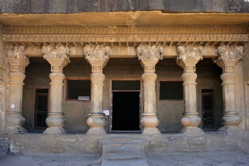
The Western Satrap period is closely associated with the development of Buddhist cave architecture in western India. Karla, Nasik, Junnar, Kanheri, Lenyadri, and Manmodi preserve inscriptions connected with rulers, officials, and donors.
The Great Chaitya at Karla was constructed and dedicated in 120 CE under Nahapana. It is described as the largest chaitya hall in South Asia. Its association with the Satrap court illustrates the close relationship between political patronage, trade routes, and monastic institutions.
At Nasik, Cave 10, known as the Nahapana Vihara, contains sixteen rooms and inscriptions recording its creation and donation to the Buddhist Samgha by Ushavadata. The inscriptions also mention cisterns and financial support for monks. Dakshamitra, Nahapana's daughter and Ushavadata's wife, is recorded as donating a cave.
The location of these complexes along routes through the western Deccan was significant. Monasteries benefited from connections with merchants and officials moving between the coast, plateau, and inland centres.
Religious pluralism
The political and religious landscape was not exclusively Buddhist. Ushavadata's inscription records gifts to Brahmanas and Devas, including villages and other charitable donations. At the same time, Buddhist caves and monastic communities received substantial patronage.
This pattern indicates that elite donors supported multiple religious communities. It is not evidence that the Western Satrap state adopted a single official religion. The inscriptions instead present rulers and officials as patrons participating in several established traditions.
Devnimori and Buddhist art
The site of Devnimori in Gujarat contains Buddhist viharas and a stupa associated with the later Western Satrap period. Coins of Rudrasimha were found inside the stupa. The Buddha images show the influence of Gandharan artistic traditions and have been described as examples of Western Indian art under the Satraps.
This artistic tradition has been proposed as an important link between Gandhara and the western Deccan. It may also have influenced later developments associated with Gupta-period art at Ajanta, Sarnath, and other sites. The exact pathways of artistic transmission remain a matter of scholarly interpretation, but the map places Devnimori within a wider network of Buddhist sites and political centres.
Languages and scripts
The early coinage of the Western Satraps used combinations of Greek, Kharoshthi, and Brahmi scripts. Kharoshthi was eventually abandoned, while Brahmi continued alongside pseudo-Greek lettering on the coin obverse.
Prakrit was used in many inscriptions and coin legends. Sanskrit became increasingly prominent. The early Sanskrit inscription associated with Ushavadata at Nasik has hybrid features, while Rudradaman's Junagadh inscription is the earliest surviving long inscription in relatively standard Sanskrit.
The Junagadh inscription is particularly important for the history of political language. Its polished Sanskrit style helped establish a model for later royal inscriptions, including those of the Gupta period. The language of the court therefore formed part of the Satraps' presentation of authority as Indian and culturally legitimate.
Astrology and intellectual exchange
During Rudradaman's reign, the Greek writer Yavanesvara translated the Yavanajataka from Greek into Sanskrit. The work became influential in the development of horoscopic astrology in India. This translation reflects the intellectual connections linking the western Indian political sphere with the Greek-speaking world.
The record does not establish the size or institutional form of Rudradaman's court library or scholarly circle. It does, however, associate his reign with Sanskrit literary culture and the transmission of technical knowledge.
Military Geography
The Satavahana frontier
The principal military contest in the map's southern and southeastern zones was the struggle between the Western Satraps and the Satavahanas. Nahapana's earlier expansion had taken territory from the Satavahana sphere in western and central India. Gautamiputra Satakarni later reversed this expansion and defeated the Kshaharata dynasty.
Rudradaman I restored Satrap power across much of the contested region. His inscription claims two victories over Satakarni, but does not name the battlefields. The marriage alliance between Rudradaman's daughter and Vashishtiputra Satakarni softened the consequences of the conflict without ending political rivalry.
The late second-century victories of Yajna Sri Satakarni again reduced Satrap power in the south. Inscriptions at Nasik and Kanheri attest to renewed Satavahana authority. The southern frontier was therefore dynamic, and the map should not imply that Rudradaman's maximum claim remained unchanged for the entire second century.
The Yaudheyas
Rudradaman's Junagadh inscription celebrates the defeat of the Yaudheyas. It portrays them as a proud warrior community that resisted submission. The inscription does not provide a detailed campaign route or identify a battlefield.
The Yaudheya conflict demonstrates the importance of the northern frontier, where the Satraps encountered independent or semi-independent political formations. Because the location and chronology of the campaign are not fully established, the map marks the conflict directionally rather than with a single exact point.
Military organisation
The available evidence names rulers, viceroys, ministers, and military actions, but it does not preserve a complete account of army organisation, troop numbers, recruitment, or garrison distribution. No reliable army-size estimate is available for Rudradaman's kingdom.
Ushavadata's role indicates that high officials could command forces and conduct campaigns on behalf of the ruling house. The political geography of the kingdom depended on the ability to defend a wide range of regions, from the western coast to Malwa and the northern frontier, but the precise institutional arrangements are unknown.
Fortified and strategic locations
Urban centres such as Ujjain and Bharukachchha were strategically important because they controlled inland and maritime connections. Nasik, Junnar, and Karla occupied routes through the western Deccan. Junagadh and the Saurashtra peninsula formed a core western zone of royal authority.
The evidence does not identify a complete chain of fortresses or military roads. Caves and religious establishments should not automatically be interpreted as military strongholds. Their importance lay primarily in patronage, pilgrimage, residence, and their position along routes of movement.
Political Geography
Relations with the Kushans
The Western Satraps were contemporaries of the Kushans, who ruled much of northern India. Their early relationship with the Kushan Empire remains uncertain. The title Satrap suggests possible subordination to a higher imperial authority, and the statue of Chastana at Mathura was found with statues of Kushan rulers.
Kanishka's Rabatak inscription claims Ujjain among the territories under Kushan control. This claim, combined with the Mathura statue, has led many historians to propose Kushan influence or suzerainty over the Western Satraps, at least during the earlier period. The question is not fully settled, and the map presents the northern connection as a political relationship rather than a fixed imperial border.
Relations with the Satavahanas
The Satavahanas were the Western Satraps' most persistent rival in western and central India. Their frontier shifted repeatedly between Gujarat, Malwa, northern Konkan, Nasik, Poona, and the western Deccan.
Marriage diplomacy operated alongside warfare. Rudradaman's daughter married Vashishtiputra Satakarni, yet Rudradaman still claimed to have defeated Satakarni twice. The relationship illustrates how dynastic alliances could coexist with competition for territory and revenue.
Alliances and subordinate rulers
The alliance with the Uttamabhadras against the Malavas shows that regional powers could cooperate with the Satraps in wartime. The record of Ushavadata's intervention describes the release of the Uttamabhadra chief and the defeat of the Malavas.
The title of viceroy used for Ushavadata indicates delegation within the Satrap polity. Other rulers may have governed as sub-kings or subordinate members of the ruling family. Coin legends from the later period identify several rulers who may have exercised authority simultaneously, but the precise division of power is not always clear.
Indianisation and royal legitimacy
The Western Satraps were of Indo-Scythian or Saka origin, but their inscriptions and political practices became deeply connected with Indian cultural forms. They used Prakrit and Sanskrit, patronised Buddhist and Brahmanical institutions, adopted Indian royal titles, and issued coins drawing on Indo-Greek and local traditions.
Rudradaman's Sanskrit inscription is especially significant. It presents the ruler as a conqueror, patron, and protector of an orderly kingdom. The description of territories, towns, markets, and rural areas was not merely geographical; it was also a statement of sovereignty and legitimate kingship.
Legacy and Decline
Later Kardamaka rulers
The Western Satraps continued for several centuries after Rudradaman. The coin record names rulers such as Jivadaman, Rudrasimha I, Rudrasena II, Visvasena, and Rudrasimha II. Dated coins from the Saka era make it possible to reconstruct parts of this later sequence with unusual precision.
Under Rudrasena II, the dynasty appears to have reached a high level of prosperity. The Sanchi–Vidisha–Eran region was again connected with Satrap rule, and a marital alliance may have linked the Western Satraps with the Andhra Ikshvakus. An inscription from Nagarjunakonda identifies Rudradhara-bhattarika, wife of the Ikshvaku ruler Virapurushadatta, as the daughter of the ruler of Ujjain, possibly Rudrasena II.
The Kanakerha inscription at Sanchi and related records connected with Sridharavarman show that Saka authority continued in parts of central India into the fourth century. These inscriptions demonstrate that political control in the region remained changeable and that the Western Satrap presence outlasted the earliest conflicts with the Satavahanas.
Pressure from the northwest
From around 350 CE, Sasanian expansion affected Gandhara, Punjab, and the lower Indus region. Kushano-Sasanian and Sasanian power in the northwest may have reduced the influence of the remaining Kushan rulers and affected the wider political balance of western India.
The precise impact of Sasanian expansion on the Western Satraps is uncertain. Sasanian coinage in Sindh suggests influence or control in the lower Indus region, but the surviving evidence does not provide a complete account of how the Satraps responded.
Gupta conquest
The Western Satraps were eventually defeated by the Gupta Empire. Samudragupta's western campaigns may have displaced the Saka ruler Sridharavarman from the region around Eran, although the interpretation of the relevant inscriptions is not completely certain.
The final phase is associated with Rudrasimha III and the campaigns of Chandragupta II. A later literary account, the Natya-darpana, tells a dramatic story in which the Gupta prince Chandragupta kills Rudrasimha after disguising himself as a woman to enter the Saka camp. This narrative includes legendary or literary elements and should not be treated as a straightforward campaign report.
Inscriptions of Chandragupta II dated 412–413 CE at Sanchi attest to Gupta victory and western expansion. The Western Satraps' rule ended during the early fifth century, conventionally around 415 CE. The exact sequence of the final campaigns is less secure than the broad conclusion that Chandragupta II incorporated their territories into the Gupta Empire.
Monetary and cultural afterlife
The Gupta rulers Chandragupta II and Kumaragupta I adopted the Western Satrap silver coin format. Their coins preserved the ruler's bust and pseudo-Greek lettering but replaced the Satrap reverse design with the Garuda, the Gupta dynastic emblem.
Later dynasties, including the Traikutakas and the rulers of Valabhi, also adopted elements of the Western Satrap monetary style. This continuity shows that the Satraps' influence survived their political defeat.
Their inscriptions contributed to the expansion of Sanskrit royal epigraphy. Their Buddhist cave patronage shaped the religious landscape of western India, while their ports and inland centres participated in long-distance trade linking the subcontinent to the Mediterranean and Arabian worlds.
Reading the Map
This map should be read as a reconstruction of political geography rather than as a modern state boundary map. The strongest evidence for the territory of Rudradaman I comes from the Junagadh inscription, supported by coins, inscriptions at other sites, and ancient geographical writing.
Ujjain represents the inland political and commercial centre. Bharukachchha represents the maritime gateway. Saurashtra and Gujarat form the western core, while Malwa, Sindh, northern Konkan, and parts of central India illustrate the broad extent claimed by the Satrap ruler.
The Satavahana frontier is shown as a zone of contest because political control changed over time and because the evidence does not always distinguish a permanent border from a temporary campaign. The northern Yaudheya conflict is similarly represented without assigning an exact battlefield. Kushan connections are shown as a debated political relationship, not as a simple annexation.
The result is a map of a connected but contested realm: a Saka polity whose power rested on royal capitals, ports, inland markets, coinage, delegated officials, religious patronage, and military campaigns across the varied landscapes of western and central India.