Overview
Beside the Dhansiri River, the modern city of Dimapur preserves the remains of a much older fortified capital. During the medieval period, it served as the political centre of the Dimasa Kingdom, also called the Kachari Kingdom in historical accounts. Brick walls, gateways, reservoirs, and other monumental remains once formed a substantial urban complex. These remains led European scholars and the Ahoms to describe Dimapur as the “Brick City.”
The city’s history is closely connected to the geography of the Dhansiri valley. Situated in the southwest of present-day Nagaland and near the border with Assam, Dimapur occupies a largely flat area with access to river routes, overland corridors, and later railway lines. These advantages made it valuable first as a royal capital, later as a contested frontier, and eventually as a transport and commercial gateway.
Dimapur’s medieval importance did not end with the fall of the Kachari capital. Records from the Ming dynasty and Burmese inscriptions place the Dimasa polity within wider networks extending across Northeast India and mainland Southeast Asia. In the twentieth century, the city acquired a new strategic role when it became a major Allied logistics and supply hub during the Second World War. Today, it is Nagaland’s largest city and municipality, its principal commercial centre, and a major entry point for the state.
Etymology and Names
The name “Dimapur” is commonly explained through Dimasa Kachari words: di, meaning water; ma, meaning big; and pur, meaning settlement. Under this interpretation, Dimapur means a large settlement associated with water, an apt description for a city beside the Dhansiri River.
The Ahom Buranjis sometimes refer to Dimapur as Che-din-chi-pen. This name is explained as meaning “Brick-town,” reflecting the city’s masonry structures and fortified character. The same records refer to its rulers with a distorted form of the name Dimasa, written as khun timisa. The descriptions point to a city whose identity was strongly associated with brick construction.
The name also appears in historical records beyond the immediate Brahmaputra and Dhansiri region. Ming-era references use a transcription rendered as Di-ma-sa, while Burmese inscriptions from the fifteenth century mention Timmasala. Scholars have suggested that Timmasala may refer to the Dimasa kingdom, although the identification is presented as a speculation rather than a certainty.
These different names show that Dimapur was known through several political and cultural worlds. Local and regional traditions remembered it as the city of the Dimasa people; Ahom records emphasised its brick-built character; and Chinese and Burmese records placed its ruling polity within broader diplomatic and political networks.
Geography and Location
Dimapur lies in the southwest of Nagaland, close to Assam. The city stands along the Dhansiri River, a tributary of the Brahmaputra, which flows to the east of the urban area. The river was historically known as Dong-siri, a name associated with a ravine of peaceful habitation.
The surrounding landscape is predominantly flat. This distinguishes Dimapur from many hill settlements of the wider region and helps explain its importance as a place of movement and exchange. The flat Dhansiri valley provided room for a large fortified settlement, reservoirs, roads, railway infrastructure, and later urban expansion.
The same geography also made Dimapur strategically exposed. The valley formed an approach between the Assam plains and the hill regions farther east and south. During the Ahom–Kachari conflicts, armies moved through the Dhansiri valley toward the Kachari capital. Centuries later, roads and railway lines through the area supported Allied operations toward Kohima, Imphal, and Burma.
Dimapur has hot and humid summers and moderately cold winters. Its modern location continues to support transport connections. The city is served by rail, major highways, and the state’s only civil airport, which is located at 3rd Mile in the neighbouring Chümoukedima District.
Early and Medieval History
Capital of the Kachari Kingdom
Dimapur served as the capital of the Dimasa Kingdom during the medieval period. The surviving remains suggest that this was not a small royal residence but an extensive and organised urban centre. Its fortifications, gateways, tanks, and monumental structures indicate considerable political power, labour, and architectural development.
One tradition attributes the foundation of the city to the Kachari king Mahamanipha, whose reign is placed approximately between 1330 and 1370. The date is therefore a traditional and approximate one rather than a securely fixed foundation date. The archaeological and architectural remains establish the scale of the settlement, but the surviving evidence does not provide a single uncontested date for its construction.
The ruins include a brick wall nearly two miles long and two tanks measuring approximately 300 yards square. These dimensions indicate a city of considerable size. The tanks would have had practical importance for water management, while the walls marked and protected the royal settlement. Gateways and other remains added to the capital’s monumental character.
Dimapur’s importance was also expressed through political traditions. In the early nineteenth century, Dimasa chiefs, assisted by Brahmins, developed genealogical claims connecting themselves to the Mahabharata. According to the court tradition, the Pandavas visited the Kachari Kingdom during their exile. Bhima married Hidimbi, the sister of Hidimba, and their son Ghatotkacha became an ancestor of the Kachari ruling line. This account formed part of a process of Sanskritisation and should be understood as a later political and cultural genealogy rather than as an independently verified account of the city’s foundation.
Connections with the Ming and Ava Worlds
Dimapur’s medieval history extended beyond the conflicts of the Brahmaputra region. Between 1406 and 1439, the Ming dynasty appears to have maintained political contacts with the Dimasa and neighbouring kingdoms.
In 1406, the Ming court recognised the Dimasa kingdom as a tusi, a form of recognised local administration within the Ming imperial order. A Pacification Superintendency was established, and Lawangpa was appointed as the Dimasa Pacification Superintendent. The Ming court sent Zhou Rang, a Supervising Secretary, to deliver imperial orders, patents, seals, paper money, silks, and other gifts. In return, the Dimasa ruler sent horses and local products as tribute.
Another recorded exchange took place in 1425. Paper money, ramie silks, silk gauzes, and thin silk were given to Mazhiasa, who had been sent to the Ming court by Diedaomangpa, the acting head of the Dimasa Pacification Superintendency.
The kingdom may also appear in Burmese records. A 1400 inscription associated with the Yan-anng-myin pagoda refers to a place called Timmasala when describing the extent of the kingdom of Ava. The inscription states that Ava extended east to Shan Pyi, northwest to Timmasala, west to Kula Pyi, and south to Talaing Pyi. A 1442 inscription from Pagan identifies Timmasala, described as the land of the Hill Kacharis, as one of twenty-one principalities under the Mong Mao ruler Thonganbwa.
The identification of Timmasala with the Dimasa kingdom remains interpretive. Even so, the Ming records and Burmese inscriptions show that the polity associated with Dimapur belonged to a wider regional world. Its history was not confined to relations with Assam and the hill societies of Northeast India; it also intersected with diplomatic and political systems extending into China and Burma.
Historical Timeline
Ahom–Kachari Conflict
The political power of Dimapur was challenged by the Ahom kingdom during the sixteenth century. The conflict began under the Ahom ruler Suhungmung in 1526. The first campaign did not immediately lead to the conquest of Dimapur, but hostilities resumed after the construction of an Ahom fort at Marangi in the lower Dhansiri region.
According to Edward Gait, an Ahom army defeated a Kachari force commanded by Detcha in 1531. The Ahoms then advanced up the Dhansiri River, pursued the retreating army to Dimapur, and forced the Kachari king Khunkhara to flee. A Kachari prince named Detsung was installed as ruler under Ahom suzerainty.
Detsung later resisted Ahom authority. In 1536, another Ahom expedition entered Dimapur. Detsung fled, was eventually captured, and was killed at Jangmarang. After this defeat, the Kachari royal house abandoned Dimapur and transferred its political centre southward to Maibang.
The change was a decisive turning point. Dimapur’s fall meant that the city ceased to be the seat of the Kachari royal house. Yet the Ahoms did not permanently annex and settle the upper Dhansiri valley. Gait described the Kachari capital as having been “twice occupied,” but stated that the Ahoms “never attempted to occupy” the Dhansiri valley as a permanent possession. Much of the area later reverted to forest.
Ahom administration was concentrated farther north, in the lower Dhansiri or Marangi frontier. An official known as the Marangikhowa Gohain was appointed there. This distinction matters: Dimapur was defeated and abandoned as a capital, but it was not transformed into a permanently administered Ahom city.
The frontier remained unsettled. In 1606, Pratap Singha led an expedition through the Kopili and Dhansiri valleys after a Kachari incursion. The Kacharis later attacked the Ahom force at Raha, killed Sundar Gohain, and drove away the survivors. The Ahom king then sought conciliation. He settled four hundred Ahom families around Marangi and proposed an embankment along the Kachari boundary. The plan was abandoned after nobles argued that a fixed frontier might limit future expansion.
Nineteenth-Century Political Genealogies
By the early nineteenth century, Dimasa chiefs, with assistance from Brahmins, claimed descent from Hidimba and the Pandava Bhima. The resulting genealogy connected the Kachari ruling line to the Mahabharata through the marriage of Bhima and Hidimbi and the birth of Ghatotkacha.
The tradition also described Ghatotkacha as ruling the Kachari Kingdom for many decades and presented later kings as ruling across the territory of the “Dilao” river, identified with the Brahmaputra. It placed this long royal succession before the fourth century CE. The account reflects the political and cultural work of court genealogies: it linked the ruling house to a prestigious Sanskritic past and placed the Dimasa kingdom within a wider legendary history.
Lease to Assam and Nagaland
In 1918, Dimapur was reportedly leased by the then Assam Province of British India to the Naga Hills District for thirty years, allegedly for the construction of railway lines. The precise administrative details of the arrangement are unclear, and the claim remains controversial.
In 1963, Dimapur was reportedly leased again, this time to the state of Nagaland for ninety-nine years. Both state governments have not publicly settled the controversy described in the historical account. The issue illustrates the complicated administrative history of a city located near the boundary between Assam and Nagaland.
Second World War
During the Second World War, Dimapur became a major centre of military movement and supply. The city served as a staging post for the Allied offensive against Imperial Japan. Japanese forces advanced toward Kohima, where a siege was fought, while Allied reinforcements moved through Dimapur by rail and road.
An airport at Dimapur was also used to supply Allied forces in Burma. The city’s transport connections gave it a role far beyond its immediate urban area. Supplies and troops could arrive by rail, continue along roads, and move toward the active fronts.
William Slim’s account of the war identified three important all-weather roads prepared by the Allied forces: the Ledo Road in the north, the central road from Dimapur to Imphal, and a southern road from Dohazari toward Arakan. A road from Dimapur to Imphal had existed earlier, but a new road was built in 1942–43 with assistance from pioneers of the 7th Battalion, Worcestershire Regiment.
The Dimapur–Imphal road became the most critical of these routes as events developed. The Battle of Kohima, approximately 77 kilometres from Dimapur, is regarded as a turning point in the Japanese retreat from Southeast Asia. Dimapur’s wartime significance therefore rested not on a single battle within the city, but on its role as the logistical base that sustained operations toward the front.
Political and Military Significance
Dimapur’s political importance changed repeatedly. As the capital of the Dimasa Kingdom, it represented royal authority in the Dhansiri valley. Its fortifications and reservoirs expressed the capacity of the Kachari state to organise labour, manage water, and defend a substantial urban centre.
The Ahom campaigns transformed Dimapur into a frontier objective. The city’s capture in 1531 and again in 1536 weakened the Kachari royal house and led to the transfer of the political centre to Maibang. Yet the subsequent absence of permanent Ahom settlement shows that military occupation and administrative incorporation were not the same thing.
In the twentieth century, geography gave Dimapur a new military function. Railways, roads, and an airport made it a supply centre for the Allied war effort. Its historical importance thus spans two very different forms of strategic value: first as a fortified royal capital, and later as a modern logistics hub.
Religious and Cultural Importance
Modern Dimapur has a heterogeneous population drawn from different parts of India. This diversity has led to the city’s popular description as “Mini India.” According to the 2011 census figures given for the old Town Committee area, Christianity was followed by 45.10 percent of the population and Hinduism by 41.11 percent. Islam accounted for 11.21 percent, Jainism for 1.73 percent, Buddhism for 0.48 percent, and Sikhism for 0.19 percent.
The city’s religious landscape includes the Dimapur Jain Temple, built in 1947. The temple is known for its intricate glass work and is regarded as auspicious by many residents. Its construction was associated with the efforts of several Jain families and community members, including Jethmal Sethi, Phulchand Sethi, Udayram Chabra, Chunnilal Kishanlal Sethi, Kanhaiyal Sethi, Mangilal Chabra, Motilal Patni, and Subhkaran Sethi.
Other religious and cultural attractions include Shiv Mandir and Kali Temple. Together with the Kachari ruins, these places reflect the layered character of Dimapur: a city shaped by Dimasa political memory, later regional histories, and a diverse modern population.
Economy and Urban Life
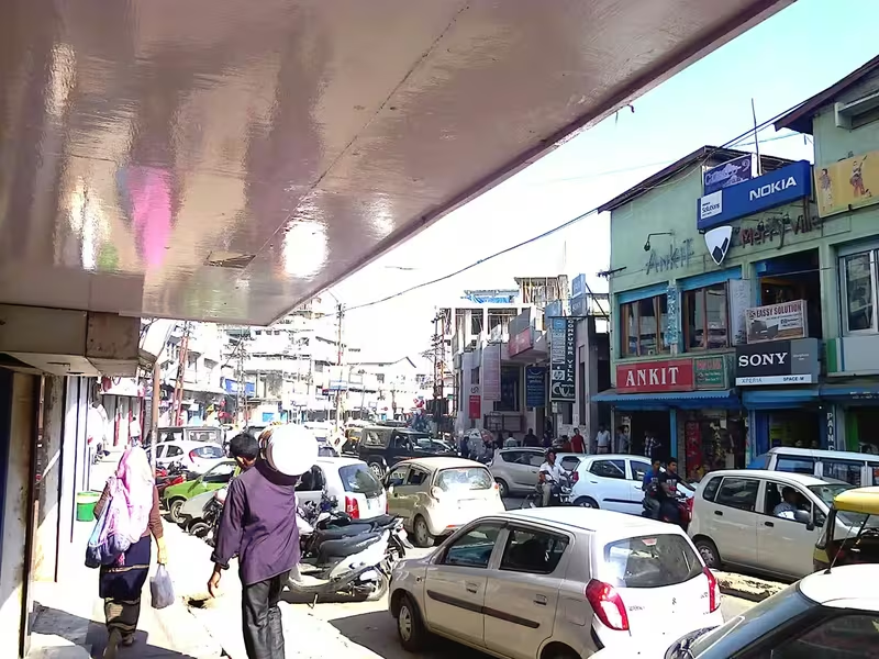
Dimapur is the commercial centre of Nagaland. Goods arrive by train at Dimapur railway station and by road along National Highway 29 before being distributed to other parts of the state. The city contains private and central banks, hotels, educational institutions, markets, and transport services.
Hong Kong Market is one of Dimapur’s best-known commercial areas. It is associated with imported goods from Thailand, China, and Burma and attracts visitors looking for products connected to these trading networks. Other important commercial areas include Central Plaza, New Market, Bank Colony or the Super Market Area, Circular Road, and NL Road.
Wholesale food grains are available at the K. L. Sethi Market Complex and Jasokie Market on G. S. Road. Commercial growth has also spread toward Notun Bosti. The stretch from Purana Bazaar to Chümoukedima along the Asian Highway 1 is developing rapidly as a commercial corridor.
This modern economy continues the city’s older pattern of connecting different regions. Medieval Dimapur drew power from its position in the Dhansiri valley; modern Dimapur draws commerce from its railways, roads, airport, and relationship with the rest of Nagaland.
Monuments and Places to Visit
Ruins of the Kachari Rajbari
The ruins of the Kachari Rajbari are the most important historical remains in Dimapur. Although centuries of abandonment, conflict, and urban settlement have altered the original site, the surviving structures preserve the memory of the former Kachari capital.
The old fortified area once included a brick wall nearly two miles long, gateways, tanks, and monumental remains. Urban settlement now occupies a large part of the former fortress, but the ruins remain a major heritage site and an important historical marker for Northeast India.
Dimapur City Tower
The Dimapur City Tower, also called the Clock Tower, stands on Circular Road in the heart of the city. It is a major urban landmark and is decorated with Christmas lights during the Christmas season.
Dimapur Jain Temple
Built in 1947, the Jain Temple is distinguished by intricate glass work. It represents the history of Jain families and commercial communities that contributed to the development of modern Dimapur.
Parks and Natural Attractions
Visitors can also find the Nagaland Science Center, Stone Park, Hazi Park, and other recreational sites in and around the city. The Rangapahar Wildlife Sanctuary, Nagaland Zoological Park, Green Park, Niathu Resort, Noune Resort, Triple Falls, Aqua Mellow Park, and the Agri Expo site in neighbouring Chümoukedima District are accessible from Dimapur.
Transport and Connectivity
Dimapur is the main gateway to Nagaland. Its airport, located at 3rd Mile in Chümoukedima District, is the only civil airport in the state. It operates flights to Kolkata, Guwahati, Imphal, and Dibrugarh.
The railway station is one of two railway stations in Nagaland, the other being Shokhüvi railway station. Dimapur station is classified as an A-category station on the Lumding–Dibrugarh section of the Lumding railway division under Northeast Frontier Railway. It provides direct services to Guwahati, Kolkata, Patna, New Delhi, Bengaluru, Chandigarh, Amritsar, Dibrugarh, and Chennai. It is also described as the second-busiest railway station in Northeast India.
Several important roads pass through or near the city, including Asian Highways 1 and 2, National Highway 29, National Highway 129, and National Highway 129A. These connections support the movement of people and goods and reinforce Dimapur’s position as Nagaland’s principal transit hub.
Modern City
In 2011, the old Town Committee area, extending up to the old Dhansiri bridge, had a population of 122,834. The municipality’s population was reported as 172,000 in 2024. In the 2011 figures, males formed 52 percent of the population and females 48 percent. The literacy rate was 86 percent, with male literacy at 88 percent and female literacy at 84 percent. Twelve percent of the population was under six years of age.
Dimapur’s educational institutions include Dimapur Government College, Public College of Commerce, Salesian College of Higher Education, Sakus Mission College, Trinity Theological College, Unity College, Pranab College, S. D. Jain Girls College, Cornerstone College, Ngullie Memorial College, and several others. The city also has numerous schools, including Don Bosco Higher Secondary School, Holy Cross School, Greenwood School, and St. John Higher Secondary Residential School.
The city experienced a tragic episode on 2 October 2004, when two powerful bombs exploded—one at Dimapur Railway Station and another at Hong Kong Market. Thirty people were killed and more than one hundred injured.
Despite this violence and the pressures of rapid growth, Dimapur remains the principal urban and commercial gateway to Nagaland. It has also been ranked twenty-eighth among India’s “National Clean Air Cities” in the category for cities with populations below 300,000.
Decline and Revival
Dimapur’s medieval decline followed the defeat of the Kachari royal house and the transfer of the capital to Maibang. The Ahom occupation was temporary, and the Dhansiri valley later became largely forested rather than developing into a permanent Ahom administrative centre. Urban abandonment and later settlement obscured much of the original fortified city.
The city’s revival came through new forms of connectivity. Railway construction and later road development brought Dimapur into wider regional networks. During the Second World War, its transport infrastructure turned it into an Allied supply centre. After the formation of Nagaland as a state, the city expanded as a commercial and administrative gateway.
Modern Dimapur is therefore not simply a surviving medieval capital. It is a layered urban space in which the remains of the Dimasa kingdom coexist with markets, railway platforms, highways, religious institutions, schools, and new commercial districts.
Timeline
Traditional foundation period
One tradition associates the founding of Dimapur with the Kachari king Mahamanipha, whose reign is placed approximately between 1330 and 1370.
Ming recognition
The Ming court recognised the Dimasa kingdom as a tusi and established a Pacification Superintendency.
Diplomatic exchange
The Ming court conferred paper money and various silks on a representative sent by the Dimasa polity.
First major Ahom occupation
After defeating a Kachari army, Ahom forces advanced to Dimapur and compelled King Khunkhara to flee.
Fall of the Kachari capital
A renewed Ahom expedition entered Dimapur; the Kachari royal house later transferred its political centre to Maibang.
Contested frontier
Conflict continued through the Kopili and Dhansiri valleys, followed by Ahom efforts to settle families around Marangi.
Reported lease to the Naga Hills District
Dimapur was reportedly leased for thirty years for railway construction, though the administrative details remain disputed.
Wartime road construction
A new Dimapur–Imphal road was built during the Second World War with assistance from the 7th Battalion, Worcestershire Regiment.
Allied logistics hub
Dimapur supported Allied operations toward Kohima, Imphal, and Burma during the campaign against Japan.
Dimapur Jain Temple
The Dimapur Jain Temple was built and became a notable religious landmark.
Reported lease to Nagaland
Dimapur was reportedly leased to the state of Nagaland for ninety-nine years, a claim surrounded by controversy.
Bombings
Bomb explosions at Dimapur Railway Station and Hong Kong Market killed 30 people and injured more than 100.
Modern municipal centre
Dimapur had a reported municipal population of 172,000 and remained Nagaland’s main commercial gateway.