Overview
At the mouth of the Narmada River, where inland waterways meet the Gulf of Khambhat, stands Bharuch—an urban centre whose history reaches from early Indian traditions to the chemical industries of modern Gujarat. In antiquity the city was known as Bharukaccha and, to Greek and Roman writers, as Barygaza. Its position made it a natural meeting point between the interior of the Indian subcontinent and maritime routes across the Arabian Sea.
Bharuch was not simply a coastal settlement. It was a river port, a transshipment centre, a shipbuilding location and a stopping point on routes that connected the Far East, western India and the Mediterranean world. Before the widespread use of the compass and modern weather forecasting, sailors depended on familiar coastlines, sheltered waters and the regular pattern of monsoon winds. Bharuch offered all three kinds of advantage in different ways: the Gulf of Khambhat provided access by sea, while the east–west course of the Narmada opened a route into central and northern India.
The city has passed through several political phases. It was associated with the Pradyota dynasty, later became part of the Mauryan Empire, and was connected with the Western Satraps, Guptas, Gurjaras, Gurjara-Pratiharas, Maitrakas and Rashtrakutas. In the early modern period, the Sultanate of Gujarat, the Portuguese, the Marathas and the East India Company all sought influence over it. Alongside this political history, Bharuch developed as a pilgrimage centre, a textile town and a home of Gujarati communities whose traditions remain part of the city's identity.
Today Bharuch is the administrative headquarters of Bharuch District. It is also one of the most heavily industrialised areas of Gujarat, with chemical plants, textile mills, cotton production, dairy products and associated manufacturing around Bharuch, Ankleshwar, Jhagadia and Dahej. The ancient port has changed, but the relationship between geography, commerce and movement continues to define the city.
Etymology and Names
The oldest recorded form of the city's name is Bharukaccha. The name is closely associated with the city's sacred and geographical identity, particularly the traditions surrounding Bhrigu Rishi and the Narmada. The modern name Bharuch developed from this older form.
Greek writers rendered the name as Barygaza, written in Greek as Βαρύγαζα. The name was also recorded in forms such as Bargosa. Roman writers adopted the Greek name for the port. In the first century CE, the Periplus of the Erythraean Sea referred to Barygaza as a major destination and described the movement of cotton cloth, coins and goods through the port.
The city's name changed again with shifts in political control and administrative language. It was known as Bharuch under Muslim rule, Bhadoch during Maratha rule and Broach under British rule. These names reflect not only pronunciation but also the way different political and commercial communities encountered the city.
Several modern names express aspects of Bharuch's economy and landscape. Because of the distinctive colour of its soil, which is also suitable for cotton cultivation, the region is sometimes called Kanam Pradesham, or “black-soil land.” Bharuch is also nicknamed Peanut City because of its long-established salty-peanut processing and marketing industry. The local product is known as Khari Singh.
Geography and Location
Bharuch lies at approximately 21.7° north latitude and 72.97° east longitude. It stands on the banks of the Narmada near the river's mouth, with the Gulf of Khambhat to the west. The district is bordered by Vadodara to the north, Narmada to the east and Surat to the south.
This position shaped the city's past in several ways. The Narmada provided access toward the interior, while the Gulf connected Bharuch to maritime routes along the western coast of India. The river's east–west course gave merchants a route toward inland empires, caravan networks, the Ganges valley and the plains around Delhi. At a time when moving heavy goods over land was difficult, the combination of river and sea transport gave Bharuch a major logistical advantage.
The city also occupied a relatively sheltered position on the Gulf of Khambhat. Coastal shipping in the pre-compass era depended on the ability to follow shorelines and find safe places to wait. Bharuch's river and coastal setting helped ships and cargoes move through this system. The port's importance therefore came from more than proximity to the sea: it came from the connection between coastal shipping and inland circulation.
Bharuch has a tropical savanna climate strongly moderated by the Arabian Sea. Summer begins in early March and continues until June. April and May are the hottest months, when average maximum temperatures reach about 40°C. The monsoon begins in late June, and the district receives around 800 millimetres of rainfall by the end of September. During the monsoon months, average maximum temperatures are around 32°C.
October and November bring the retreat of the monsoon and a short return of higher temperatures. Winter lasts from December to late February, with average temperatures of approximately 23°C. Heavy monsoon rainfall has often caused flooding in the Narmada basin. Major floods affected Bharuch in the past, although flooding has been largely controlled since the Narmada was dammed.
The damming of the river also changed the old port system. The original port facilities are no longer active in the same form, and Dahej, about 50 kilometres to the west, is now the nearest major port facility. Gujarat's biggest liquid cargo terminal is located at Dahej, tying the modern industrial economy of the Bharuch region to a different maritime infrastructure from that of the ancient river port.
Ancient History
Bharuch and its surroundings have been settled since antiquity. Early references connect the area with the Pradyota dynasty of Ujjain. According to historical accounts, King Pradyota Mahavira ruled Bharutkutchha around 550 BCE and was a contemporary of Gautama Buddha.
Bharuch also appears in early Buddhist literary traditions. The Theragatha, part of the Pali Canon written down in Sri Lanka in the first century BCE, refers to Vaddha Thera and Malitavamba Thera of Bharukaccha. The Therigatha mentions Vaddhamta Theri of the same place. These references show that Bharukaccha was known within a wider religious and literary world, although the texts do not provide a detailed description of the settlement itself.
The Sri Lankan chronicle known as the Dipavamsa records a tradition that the legendary King Vijaya stopped at Bharutkutchha for three months around 500 BCE. This belongs to the realm of historical tradition and legend rather than securely documented urban history, but it reflects the city's place in narratives of early travel across the western coast.
Archaeological discoveries near the banks of the Narmada have revealed temples and other remains. Bharuch later formed part of the Mauryan Empire, which ruled a large area of the subcontinent between 322 and 185 BCE. After the Mauryan period, the region was connected with the Western Satraps, the Guptas, the Gurjaras and the Gurjara-Pratiharas.
The city's international profile is especially visible in the Greek and Roman records of Barygaza. The Periplus of the Erythraean Sea, a first-century account of trade and navigation in the Indian Ocean, describes Barygaza as a major port. It notes that cotton cloth was brought down from the interior to the port. It also describes Greek buildings, fortifications and wells in the region, while attributing them incorrectly to Greeks who had not actually ruled that far south. The passage nevertheless records the circulation of Hellenistic cultural and monetary influences in the area.
Another passage from the Periplus states that ancient drachmae remained current at Barygaza. These coins bore Greek inscriptions and the devices of rulers who came after Alexander III of Macedon, including Apollodotus I and Menander I. The evidence points to commercial connections that lasted beyond the political territories of the Indo-Greek rulers.
Bharuch's ancient importance therefore rested on several linked systems. Goods from inland India moved toward the port. Ships arriving from the western and eastern maritime worlds brought other goods or carried Indian products onward. Seasonal monsoon winds helped ships cross the Arabian Sea, while the Narmada connected the port with the interior. Barygaza became a terminus where land and sea routes met.
Historical Timeline
Early and Imperial Periods
The earliest political traditions associated with Bharuch place it under the Pradyota dynasty around 550 BCE. It later entered the Mauryan Empire, which ruled between 322 and 185 BCE. The city remained connected with successive powers in western India, including the Western Satraps and the Guptas.
Historical accounts also place Bharuch within the political settings of the Maitraka and Rashtrakuta eras, dated in the available historical record from 470 to 788 CE and 788 to 942 CE respectively. The Pratihara Empire, whose capital was at Bhinmal or Srimal, is associated with the creation of the kingdom of Bharuch.
These changes in political authority did not erase Bharuch's commercial identity. The city continued to be recognised as a port and as a link between the coast and the inland routes of Gujarat and central India.
Sultanate and Portuguese Period
By the medieval and early modern periods, Bharuch formed part of the political world of the Sultanate of Gujarat. Its position and commercial wealth attracted European maritime powers as well as regional rulers.
In 1547, Portuguese forces under Jorge de Meneses Baroche launched a night-time attack on the city. The Battle of Bharuch ended in a Portuguese victory. The event demonstrates that the port was not merely a trading station; control over it could be pursued through military action.
The city's fortifications and riverine position contributed to its strategic value. A power controlling Bharuch could influence the movement of goods arriving by sea and travelling inland. At the same time, merchants and local authorities had an interest in preserving the commercial networks that made the port prosperous.
Maratha Rule and the East India Company
The Nawabs of Bharuch ruled the region before coming under the suzerainty of the Maratha Empire in 1685. In 1736, the royal house of Bharuch became sovereign and ruled the region independently.
During this era, Bharuch was particularly known for cotton production. The city's textile economy attracted the attention of the English East India Company. In 1771, British forces attacked Bharuch, and on 18 November 1772 the city was placed under Company rule in India. The ruling family received a hereditary pension from the British government.
The political settlement did not remain permanent. Following the ratification of the Treaty of Salbai in 1783, the fort, town and district of Bharuch were given to Mahadji Shinde in recognition of his conduct toward the English. In 1803, during the Second Anglo-Maratha War, the East India Company stormed the city. Daulatrao Shinde ceded Bharuch to the Company under the Treaty of Surji-Anjangaon.
This sequence shows how Bharuch's political history was shaped by its economic importance. Control of the city was repeatedly negotiated, attacked and transferred because its port, textiles and inland connections mattered to larger regional powers.
Political Significance
Bharuch has rarely been defined by one enduring imperial capital or a single ruling dynasty. Its importance came instead from its position as an administrative, commercial and strategic centre.
Under the early regional powers and the Mauryan Empire, Bharuch belonged to wider political systems whose authority extended beyond the immediate river basin. Under the Sultanate of Gujarat and the Marathas, it was a valuable regional centre. During the eighteenth century, the city was governed by Nawabs, the royal house of Bharuch and Maratha authorities in succession.
European powers viewed Bharuch through the same strategic lens. The Portuguese attack of 1547 and the later British interventions show how maritime powers sought to secure ports that could support trade and military movement. The East India Company's interest in cotton added another layer to this strategic competition.
Bharuch is now the administrative headquarters of Bharuch District. The modern city therefore retains a political role, though its identity is no longer based on a princely court or a contested colonial port. Its contemporary importance is closely connected with district administration, industrial planning and the management of a rapidly developing regional economy.
Religious and Cultural Importance
Bharuch is known as a tirtha, and many Hindu traditions identify it as Bhrigu Tirtha. Temples stand along the Narmada and throughout the city. The city's sacred identity is closely connected with Bhrigu Rishi, a figure associated with the origin of the name Bharukaccha.
The Bhrigu Rishi Temple stands in the Dandia Bazar area on the eastern side of the city, near the Narmada. It is dedicated to Maharishi Bhrigu, who is traditionally described as having achieved a balance between wisdom and activity. Local tradition also credits him with writing the Bhrigu Samhita, an astrological work said to contain millions of horoscopes. These claims belong to religious tradition and should be understood as part of the temple's cultural meaning rather than as independently established historical facts.
Another important tradition concerns the Nav Nathas, nine self-manifested Shivalingas located in different parts of the old city. They are known as Kamnath, Jwalnath, Somnath, Bhimnath, Gangnath, Bhootnath, Pingalnath, Siddhnath and Kashi Vishwanath. Local belief holds that these lingas existed from time immemorial and that their presence influenced Bhrigu Rishi's choice of Bharuch as a place for his ashram.
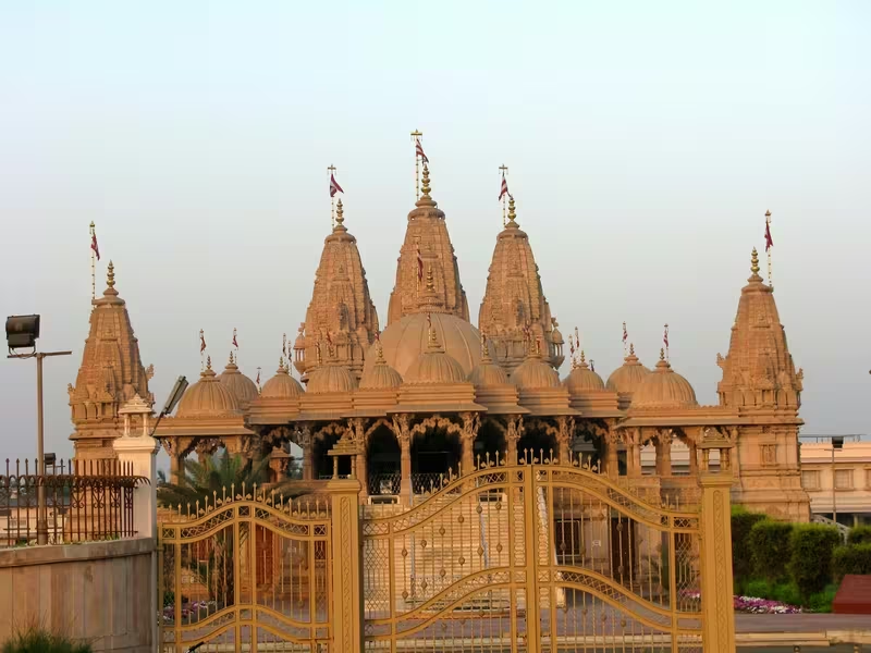
The city also contains temples associated with more recent religious communities. The Swaminarayan Temple in Dandia Bazar is described as about 175 years old. The Narmada Mata Temple, also in Dandia Bazar, is about 150 years old and dedicated to the goddess Narmada. The Vaishnav Haveli houses an image of Bal Krishna said to have come from Mathura in 1725. The Khodiyar Mata Temple, behind the old Civil Hospital, overlooks the low-lying area of Furja and is known for its view of the sunset.
Bharuch's religious landscape also includes Islamic and Sikh traditions. The city has several mosques built during the medieval period. The best known is Jamia Masjid Bharuch, constructed in 1644 during the reign of Shah Jahan.
Gurudwara Chadar Saheb recalls the visit of Guru Nanak Dev, the first Sikh Guru, who is believed to have visited Bharuch in the fifteenth century. According to the tradition, a boatman refused to carry him across the Narmada, so Guru Nanak crossed the river on a cloth sheet, or chadar. The gurdwara was later built in the Kasak area at the place where he was believed to have landed.
Bharuch has also been home to the Gujarati Bhargava Brahmana community for many generations. The community traces its lineage to Bhrigu and Parashurama, the sixth avatar of Vishnu. Bhargava institutions continue to administer numerous public trusts in the city, although many members of the community have migrated to Mumbai, Surat, Vadodara, Ahmedabad and countries including France, Britain, Australia and New Zealand.
Economic Role
Bharuch's economy has historically depended on reliable access to water, transport and surrounding agricultural production. The Narmada supported agriculture and gave the city an inland transport route. Villages around Bharuch also used the city as a shopping and commercial centre, bringing residents into town for major purchases.
Ancient Maritime Trade
Bharuch's ancient trade was based on the interaction of coastal shipping, river transport and overland routes. In the absence of modern navigation tools, sailors relied on predictable monsoon winds, galleys and familiar coastal passages. Bharuch's sheltered position on the Gulf of Khambhat made it a useful stopping point.
The port received goods from the Far East and the Far West and served as a terminus for mixed land-and-sea routes. The Periplus describes cotton cloth being brought down to Barygaza from the interior. The port's connection to the Narmada gave merchants access to central and northern India, while caravan routes extended toward the Ganges valley and the plains of Delhi.
The city was known to Greek and Roman observers, the Persian empires and other western and eastern centres of civilisation. Arab traders later entered Gujarat through Bharuch. British and Dutch merchants, referred to locally as “Valandas,” recognised the city's commercial value and established premises and local staff there.
Textiles and Cotton
Between 1500 and 1700, Bharuch became a major textile-manufacturing hub. The city was famous for bafta, a cotton textile valued in western and Southeast Asian markets. Bafta was among the important textile goods exported to Europe and other parts of the world.
Cotton also shaped the city's eighteenth-century political history. The East India Company became interested in Bharuch partly because of its cotton production. The region's dark soil, associated with the name Kanam Pradesham, was considered suitable for cotton cultivation.
Bharuch is also associated with the Bandhni method of clothing design, a traditional art form that remains part of the region's cultural economy.
Peanuts and Regional Commerce
The city is widely known for salty peanuts, or Khari Singh. Bharuch became a major centre for peanut processing and marketing, with a brand identity recognised across India. Most of the peanuts are not grown within the city itself. Instead, high-quality crops from neighbouring regions are brought to Bharuch for processing.
This distinction illustrates Bharuch's wider economic role. The city's prosperity has often depended on gathering, processing and redistributing goods from a much larger region rather than on producing every commodity within its own boundaries.
Modern Industry
Modern Bharuch and the surrounding industrial belt contain chemical plants, textile mills, cotton operations, dairy industries and other manufacturing units. The area is sometimes described as the chemical capital of India because of its concentration of chemical production.
Gujarat Narmada Valley Fertilisers & Chemicals Limited has been located in Narmadanagar, a suburb of Bharuch, since 1976. Industrial development extends into Ankleshwar, Jhagadia, Vilayata and Dahej. Companies associated with the wider area include BASF, Reliance Industries, Aditya Birla Group, UPL, Gujarat Alkalies and Chemicals, Torrent Pharmaceuticals, Gujarat Fluorochemicals, ONGC, GAIL, Petronet LNG and many others.
Dahej has become a major modern industrial and maritime zone. Petronet LNG established India's first LNG receiving and regasification terminal there. The area also contains facilities associated with energy, chemicals, tyres, metals and other industries. This modern industrial geography is related to Bharuch's older identity as a place where transport routes and commercial systems converge, although the technologies and products have changed dramatically.
Migration has contributed to the contemporary local economy. Over the past six decades, many residents have moved to the United Kingdom, the United States, African countries and parts of Europe. Their visits, remittances and spending in Bharuch have supported housing and local commerce. Retired expatriates have also returned and built homes in the city.
Monuments and Architecture
The surviving religious buildings of Bharuch reflect the city's multi-layered history rather than a single architectural style.
The Bhrigu Rishi Temple is central to the city's identity as Bhrigu Tirtha. Its setting near the Narmada gives the temple both religious and geographical significance. Pilgrims visit the site as part of the city's riverside sacred landscape.
The Nav Nathas are distributed through the old city rather than concentrated in one monumental complex. Together, the nine Shivalingas create a sacred geography that connects different neighbourhoods of Bharuch with local Shaiva traditions.
Jamia Masjid Bharuch, built in 1644 during Shah Jahan's reign, represents the city's medieval Islamic heritage. Its construction belongs to a period when Bharuch remained integrated into the political and commercial world of the Mughal era, even as local and regional powers shaped the city.
The Swaminarayan Temple, Narmada Mata Temple, Vaishnav Haveli and Khodiyar Mata Temple represent later phases of religious building and community life. Their different traditions show how Bharuch continued to absorb new devotional institutions while preserving older sacred associations.
The Gurudwara Chadar Saheb is connected with the memory of Guru Nanak's visit and the story of his crossing of the Narmada. The site is important not only as a place of worship but also as part of the city's narrative of travel, rivers and religious encounter.
Beyond the city, Shuklatirth lies about 12 kilometres east of Bharuch and contains several old temples. The most famous is the Shukleshwar Mahadev Temple. Its foundation story tells of Shiva guiding Chanakya toward liberation. In the legend, Chanakya was instructed to begin a journey at the mouth of the Narmada in a black boat, dressed in black and accompanied by a black cow. The place where the black colour turned white was to mark his liberation; this transformation was said to have occurred at Shuklatirth.
The nearby Omkarnath Vishnu Mandir contains a tall white image of Vishnu believed to have emerged from the Narmada. Tradition describes the image as made of sand and self-manifested, although its appearance resembles marble.
Kabirvad, about 16 kilometres east of Bharuch on an island in the Narmada, is associated with the saint Kabirdas. The main attraction is a gigantic banyan tree covering more than 2.5 acres. According to local tradition, Kabir meditated there and the tree grew from a meswak stick used for brushing the teeth. Over time, one tree is said to have developed many trunks and spread across the island. The site also includes a lotus-shaped marble temple, a Kabir museum and opportunities for boat rides on the Narmada.
About 45 kilometres from Bharuch, at Kavi Kamboi near the estuary of the Mahi River, stands Stambheshwar Mahadev. Its Shivalinga is submerged during high tide and visible again during low tide. The rhythm of the tides forms an essential part of the site's religious experience.
Famous Personalities
Bharuch's traditions connect the city with several mythological and religious figures, including Bhrigu Rishi, Shukra, Chyavana, Chandra, Dattatreya, Durvasa, Vamana, Mahabali, Jamadagni and Parashurama. These figures belong to the sacred narratives through which Bharuch is understood as Bhrigu Tirtha.
The historical figure King Nahapana is also associated with Bharuch. His connection belongs to the wider history of western Indian political and commercial networks.
In more recent times, people associated with Bharuch include members of the Godrej family, among them Ardeshir Godrej and Pirojsha Burjorji Godrej, co-founders of the Godrej Group. Kanaiyalal Maneklal Munshi was an independence activist, politician, writer and educationist. Feroze Gandhi, politician and journalist and husband of Prime Minister Indira Gandhi, is also associated with Bharuch.
Other notable names include Congress leader Ahmed Patel, television personality Cyrus Broacha, Hindustani classical singer and musicologist Omkarnath Thakur, businessman Premchand Roychand, Gujarati writer Tribhuvandas Luhar and industrialist and philanthropist Shapurji Broacha. The surnames Broacha and Bharucha remain common among Parsis and Dawoodi Bohras whose families originated in Bharuch.
Decline and Revival
Bharuch's history is not a simple story of decline from ancient greatness. Its port function changed repeatedly as political powers, commercial routes and technologies shifted.
At the end of the seventeenth century, the city was plundered twice. It recovered quickly, giving rise to the Gujarati proverb “Bhangyu Bhangyu Toye Bharuch,” meaning that even after being broken or damaged, Bharuch rises again. The proverb captures the city's reputation for resilience.
The old port later lost part of its role because of changes in river transport and the damming of the Narmada. The nearest major port is now at Dahej, where modern liquid cargo and LNG facilities support industrial commerce. Yet Bharuch did not disappear from regional economic life. It developed new roles in textile production, peanut processing, cotton, chemicals, fertilisers, pharmaceuticals and industrial manufacturing.
This transformation is a form of revival through adaptation. Ancient Barygaza depended on river-sea transshipment and monsoon navigation. Modern Bharuch depends on roads, industrial estates, energy infrastructure, pipelines and specialised terminals. In both periods, the city's importance comes from its ability to connect production zones, transport systems and markets.
Modern City
Bharuch is now a district headquarters and an important urban centre in southern Gujarat. The 2011 census recorded a population of 148,391, with males forming 52 percent and females 48 percent of the population. The city had a literacy rate of 97.06 percent, including 98.5 percent for males and 95.5 percent for females. Around 10 percent of the population was under six years of age.
The modern city combines several identities. It is a historic Narmada settlement, a pilgrimage centre, a shopping and service hub for surrounding villages, a textile and peanut-processing centre, and part of one of India's most industrialised regions. Its proximity to Ankleshwar GIDC and the industrial zones around Jhagadia, Vilayata and Dahej has connected the city to large Indian and multinational companies.
At the same time, Bharuch's older cultural landscape remains visible in its temples, mosques, gurdwaras and riverside traditions. Shuklatirth, Kabirvad and Stambheshwar Mahadev extend the heritage landscape beyond the city itself. The Narmada continues to provide the geographical thread linking these places.
Bharuch's heritage is therefore best understood as layered rather than static. Barygaza's ancient maritime connections, the city's medieval religious buildings, its Maratha and colonial political history, and its modern industrial economy all occupy the same regional space. The river that once carried goods toward the port still shapes the city's religious imagination, physical geography and historical identity.
Timeline
Pradyota-era Bharutkutchha
Historical accounts associate Bharutkutchha with King Pradyota Mahavira of Ujjain.
Vijaya tradition
The Dipavamsa records the legendary King Vijaya stopping at Bharutkutchha for three months.
Mauryan period
Bharuch later became part of the Mauryan Empire.
Barygaza in the Periplus
The first-century Periplus of the Erythraean Sea describes Barygaza as a major port receiving cotton cloth and circulating Greek coinage.
Portuguese attack
Portuguese forces under Jorge de Meneses Baroche captured the city in a night-time attack.
Maratha suzerainty
The Nawabs of Bharuch came under the suzerainty of the Maratha Empire.
Company rule
On 18 November, Bharuch was placed under East India Company rule after a British attack.
Treaty of Salbai
The fort, town and district were given to Mahadji Shinde after the treaty settlement.
Second Anglo-Maratha War
The East India Company stormed Bharuch, which Daulatrao Shinde ceded under the Treaty of Surji-Anjangaon.
Industrial expansion
Gujarat Narmada Valley Fertilisers & Chemicals began operations at Narmadanagar, a suburb of Bharuch.
Census population
Bharuch recorded a population of 148,391 and a literacy rate of 97.06 percent.