Shunga Empire Map: Magadha, Central India, and Contested Frontiers, c. 187–73 BCE
Introduction
The Shunga political centre lay at Pataliputra, where Pushyamitra established a new dynasty after overthrowing the last Mauryan ruler, Brihadratha, around the middle of the 2nd century BCE. From this Magadhan base, the Shunga rulers held important parts of northern and central India, but their authority was not a uniformly bounded empire in the later territorial sense. The map therefore separates the securely associated core around Magadha and Ayodhya from regions known through literary claims, diplomatic evidence, coins, or uncertain historical reconstruction.
The Shunga period is conventionally dated from approximately 187 to 73 BCE, although the dynasty’s foundation is also placed around 184 BCE and the last ruler, Devabhuti, is variously dated to 83–73 BCE. Pushyamitra is said to have ruled for 36 years and was succeeded by his son Agnimitra. Later rulers included Bhagabhadra, whose court at Besnagar near Vidisha is connected with the Heliodorus pillar. After Agnimitra, political power appears to have fragmented rapidly.
This map matters because the Shunga realm occupied a transitional landscape between the Mauryan imperial system and the smaller kingdoms, city-states, and regional dynasties that followed. Its western frontier met territories associated with the Indo-Greeks; its southern sphere overlapped with the Satavahana zone; and its central Indian monuments reveal cultural activity that cannot always be attributed directly to the royal court.
Historical Context
From Mauryan rule to the Shunga dynasty
The Shungas emerged from the political and military world of the Maurya Empire. Pushyamitra is described as the Mauryan commander-in-chief who assassinated Brihadratha while the emperor was reviewing his forces. He then took the throne of Magadha and established a dynasty that retained the central portions of the former Mauryan sphere.
The precise date of the transition varies in historical reconstructions. The dynasty is commonly placed between approximately 187 and 75 BCE, while the foundation is also dated to 184 BCE. These differences reflect the chronological problems surrounding the Puranic king lists, inscriptions, and later literary traditions.
Pataliputra remained the principal capital. The city was located on the Ganges and occupied a strategic position within the eastern Gangetic plain. It provided access to the agricultural and political heartland of Magadha, while also linking the Shunga court to routes running westward along the Ganges and southward toward central India.
Pushyamitra and the early territorial configuration
Pushyamitra’s realm essentially covered the central portions of the old Mauryan Empire. The Dhanadeva-Ayodhya inscription provides firm evidence of Shunga association with Ayodhya in northern central India. It also states that Pushyamitra performed two Ashvamedha sacrifices, traditionally connected with the assertion of sovereignty and military success.
Literary accounts assign a wider reach to Pushyamitra. The Malavikagnimitra associates his sphere with the Narmada in the south and describes a conflict involving Greek cavalry and Vasumitra, Pushyamitra’s grandson. The river named in the account is called the Sindhu, but its exact identification is uncertain. It may refer to the Indus, the Sindh, or the Kali Sindh. Because of this uncertainty, the map marks the southern and western extension as probable or contested rather than definitive.
The Ashokavadana, preserved in the Divyavadana tradition, describes a Shunga army moving from Pataliputra to Sakala in the Punjab. This account is also associated with stories of persecution of Buddhist monks. Historians disagree over how literally these passages should be read. The map shows Sakala as a reported military destination, not as an uncontested Shunga province.
Agnimitra and the later court
Agnimitra succeeded Pushyamitra. He is particularly well known through Kālidāsa’s play Malavikagnimitra, in which he appears as a prince and ruler connected with Vidisha. The drama is a much later literary composition and cannot be treated as a direct administrative record, but it preserves the importance of Vidisha in the political geography of the period.
Later Shunga rulers, including Bhagabhadra, held court at Besnagar near Vidisha in eastern Malwa. This suggests that the dynasty’s political focus was not confined to the Gangetic plain. The movement between Pataliputra and central Indian court centres may reflect the difficulty of governing a fragmented and geographically varied post-Mauryan landscape.
Chronological outline
- c. 187–184 BCE: Pushyamitra overthrows Brihadratha Maurya and establishes Shunga rule in Magadha.
- c. 187–151 BCE: Pushyamitra’s long reign; conflict with Indo-Greeks and other regional powers is associated with this phase.
- After c. 151 BCE: Agnimitra succeeds Pushyamitra; Shunga authority begins to weaken.
- Later 2nd century BCE: Besnagar and Vidisha become prominent court and diplomatic centres.
- c. 150–80 BCE: Stone architectural additions and sculptural activity appear at Sanchi and Bharhut, although royal sponsorship is debated.
- Around 110 BCE: The Heliodorus pillar records diplomatic contact between Antialcidas and Bhagabhadra.
- c. 83–73 BCE: Devabhuti is identified as the last Shunga ruler.
- Around 73 BCE: Vasudeva Kanva kills Devabhuti and establishes Kanva rule.
Territorial Extent and Boundaries
The eastern and central core
The most secure Shunga territory was centred on Magadha, with Pataliputra as its capital. The Gangetic plain offered fertile agricultural land, river transport, and access to established centres of power inherited from the Mauryan period.
Ayodhya is another securely associated location. The Dhanadeva-Ayodhya inscription connects a local ruler named Dhanadeva with Pushyamitra through a claim of descent and records Pushyamitra’s Ashvamedha sacrifices. The inscription demonstrates Shunga influence in the region, although it does not provide a complete map of provincial boundaries.
Eastern Malwa, especially the area around Vidisha and Besnagar, was also important. The association of Bhagabhadra’s court with Besnagar and the presence of the Heliodorus pillar make this one of the clearest western or southwestern points of Shunga political and diplomatic activity.
Northern frontier
The northern frontier was not a single fixed line. The Gangetic plain opened westward toward the territories of Panchalas, Mathura, and the Indo-Greek kingdoms. Literary accounts mention military activity reaching Sakala in the Punjab, but this does not prove continuous Shunga administration across the entire intervening region.
The Shunga polity may therefore be understood as a network of centres and zones of influence rather than as a solid block of territory. Pataliputra and Ayodhya are better attested than the far northwest, where Indo-Greek power was significant.
Western frontier and Mathura
Mathura is especially important for understanding the limits of Shunga power. Although geographically close to the broader northern Indian political world, it appears to have remained under Indo-Greek control during much of the period. The Yavanarajya inscription from Mathura refers to the “Yavana hegemony” and has been used to date Indo-Greek authority in the region.
No Shunga coins or inscriptions have been found at Mathura that securely demonstrate direct Shunga rule. This absence does not prove that Shunga influence never reached the city, but it makes the inclusion of Mathura within a directly administered Shunga empire unlikely. The map consequently marks Mathura as contested or outside the securely attested Shunga core.
Southern frontier
The southern extent of Shunga authority is uncertain. The Malavikagnimitra links Pushyamitra’s realm with the Narmada, and the map shows the Narmada basin as a possible southern frontier. At the same time, the Satavahana dynasty was active in the Deccan, and the extract identifies the Deccan Plateau as a region that passed into Satavahana hands.
The evidence does not establish a stable Shunga-Satavahana boundary. Conflict between the two dynasties is recorded, but the precise campaigns, dates, and territorial outcomes remain unclear.
Eastern frontier and Kalinga
The Shungas fought Kalinga, but the available record does not establish a detailed eastern boundary or a lasting Shunga conquest of Kalinga. Kalinga should therefore be shown as a neighbouring and contested region rather than as a securely incorporated province.
Direct rule, local rulers, and tributaries
The political structure was decentralised and fragmentary, particularly after Agnimitra. Inscriptions and coins indicate that much of northern and central India consisted of small kingdoms and city-states independent of Shunga hegemony. Some rulers mentioned in inscriptions may have been tributaries, neighbouring monarchs, or local powers rather than members of the Shunga dynasty.
The Bharhut inscription illustrates this problem. It refers to the rule of the “Sugas” and records a dedication by Dhanabhuti, but the wording is ambiguous. “Sugas” may mean Shungas, yet it could also refer to another group, such as the Sughanas. Dhanabhuti himself is not known from Shunga regnal lists and may have been a local ruler or tributary.
Administrative Structure
Pataliputra as capital
Pataliputra was the principal royal centre. Its position on the Ganges connected the Shunga court with the eastern Gangetic plain and the older administrative infrastructure of Magadha. The city’s importance was political as well as geographic: Pushyamitra’s seizure of Magadha established legitimacy through control of the former Mauryan heartland.
The available evidence does not provide a complete list of Shunga provinces, governors, tax districts, or administrative offices. It is therefore not possible to reconstruct a uniform provincial system comparable in detail to the administrative descriptions associated with the Mauryas.
Vidisha and Besnagar
Vidisha and Besnagar formed a second major political centre. Agnimitra is presented as a viceroy of Vidisha in Malavikagnimitra, while Bhagabhadra’s court at Besnagar is connected with diplomatic activity. The Heliodorus pillar records the arrival of a Greek ambassador from the court of Antialcidas.
This evidence indicates that the Shunga rulers operated through more than one court centre. It may also suggest that central India had considerable political importance, especially as the dynasty’s authority weakened in the Ganges basin.
Local autonomy
After Agnimitra, the political landscape became increasingly regional. Independent coinages and inscriptions point to the growth of local kingdoms and city-states. Such evidence cautions against presenting the Shunga Empire as a fully centralised state extending continuously from Punjab to the Deccan.
The map uses graded territory to represent this distinction. The red core indicates the areas most firmly associated with dynastic rule; the ochre zone represents probable or periodic authority; and the grey zone marks independent, rival, or uncertain regions.
Infrastructure and Communications
River corridors
The Ganges was the most important natural communication corridor within the Shunga heartland. Pataliputra’s location on the river connected Magadha with settlements and political centres across the Gangetic plain. The Yamuna corridor linked the eastern plain with Ayodhya, Panchala, and Mathura.
The Narmada and central Indian river systems formed another geographic zone of movement. Literary references to the Narmada and the political importance of Vidisha suggest that routes across central India mattered to Shunga rulers, particularly for communication between the Gangetic basin and Malwa.
Roads and overland movement
The period inherited routes established during earlier centuries, but the surviving evidence presented here does not allow a detailed reconstruction of a Shunga road network, postal service, or state-maintained communication system. Military expeditions described between Pataliputra, Sakala, and the western regions imply long-distance overland movement, yet the precise routes and logistical arrangements are not recorded in sufficient detail.
The map therefore shows broad geographic corridors rather than invented roads. Pataliputra–Ayodhya, Pataliputra–Vidisha, and the routes toward Mathura and the northwest are best understood as likely axes of political and military communication.
Maritime connections
No securely documented Shunga maritime system or port administration is identified in the available record. The dynasty’s main political centres were inland, and the evidence used for this map is concentrated on riverine plains, central Indian routes, inscriptions, coins, and military campaigns.
Economic Geography
The Gangetic agricultural zone
Magadha’s political importance rested partly on its position within the fertile Gangetic basin. Control of Pataliputra gave the Shunga rulers access to established agricultural resources and river transport. The available evidence does not provide population totals, tax registers, or quantified production figures for the Shunga period, so no reliable demographic estimate can be attached to the map.
Ayodhya and other cities of the northern plain occupied a transitional position between the eastern core and the western political world. Their location made them valuable for movement, communication, and military mobilisation.
Central Indian exchange zones
Vidisha and Besnagar were situated at a major intersection between the northern plains and central India. Their importance is confirmed by their association with Shunga courts and diplomacy. The region also lay near Sanchi, Bharhut, and other monument sites that received architectural and artistic investment during the post-Mauryan period.
The evidence does not identify a complete list of commodities traded through these centres. It does, however, show that central India was not peripheral to Shunga political life. It served as a courtly, diplomatic, artistic, and religious zone.
Coinage and political fragmentation
Coins are particularly significant for the late Shunga landscape. Their distribution indicates that many northern and central Indian cities and kingdoms exercised independent authority after the early phase of the dynasty. Local coinage points to political fragmentation, although coins alone do not reveal the full nature of taxation, trade, or economic integration.
The appearance of regional currencies should not be read simply as economic collapse. It demonstrates that authority was being exercised by multiple centres, each capable of expressing political identity through coin production.
Cultural and Religious Geography
Brahmanical revival and royal ideology
The Shunga rulers are associated with a revival of Brahmanical authority. Pushyamitra is said to have performed Ashvamedha sacrifices, and the Dhanadeva-Ayodhya inscription also associates him with two such rituals. These ceremonies carried political meaning, presenting sovereignty through Vedic ritual and military prestige.
The dynasty’s use of a variant of Brahmi to write Sanskrit reflects the linguistic and intellectual environment of the period. The script is considered intermediary between Mauryan and Kalinga forms of Brahmi.
Buddhism and the debate over persecution
Later Buddhist accounts, especially the Ashokavadana tradition, portray Pushyamitra as a persecutor who destroyed monasteries, attacked stupas, and offered rewards for the killing of monks. These stories have played a major role in modern interpretations of the period.
The historical picture is debated. Later Shunga rulers were associated with Buddhist monuments, and Buddhist activity continued at Sanchi and Bharhut. Inscriptions at Bodh Gaya name King Brahmamitra and King Indragnimitra, though neither is securely integrated into the Shunga genealogy. Buddhist activity in Bengal during the period is also suggested by a terracotta tablet from Tamralipti.
The surviving evidence does not support a simple map of universal persecution or universal royal tolerance. It points instead to regional variation, continued Buddhist activity, competing religious patronage, and uncertainty about the relationship between dynastic policy and local donors.
Sanchi
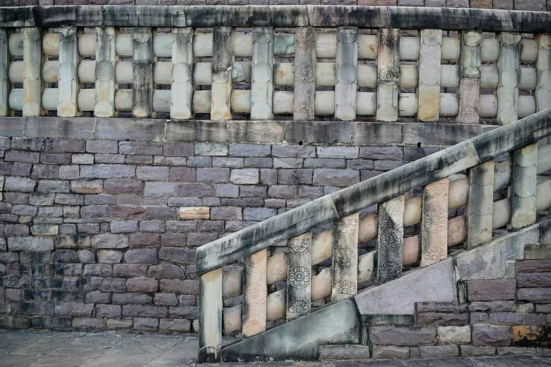
The Great Stupa at Sanchi was enlarged during the Shunga period. Its original brick structure was covered with stone, the dome was reshaped, and a high circular drum and stone balustrades were added. The second and third stupas, as well as other stone elements, are also associated with the period.
The highly decorated gateways belong to the later Satavahana period rather than the Shunga phase. Furthermore, many dedicatory inscriptions at Sanchi identify private or collective donors. Historian Julia Shaw has therefore argued that these constructions should not automatically be described as royal Shunga projects.
Bharhut
Bharhut provides important evidence for the artistic and religious geography of central India. Its stupa, railings, sculptures, and inscriptions are connected with the post-Mauryan period. The famous inscription referring to the “Sugas” is valuable but ambiguous, and it cannot by itself establish the exact political boundary of the Shunga state.
Bharhut and Sanchi display related artistic traditions. Their reliefs and architectural forms show the development of monumental Buddhist art in central India after the Mauryan period.
Bodh Gaya and other centres
Bodh Gaya remained a major Buddhist sacred site. The inscriptions naming Brahmamitra and Indragnimitra record royal women and royal households making gifts, but the precise political identities of the named rulers remain uncertain.
The period also witnessed developments in philosophy, literature, and education. Patañjali’s Mahābhāṣya and the Yoga Sutras are associated with the period in the historical extract, while the later play Malavikagnimitra preserves a literary memory of Agnimitra and the Vidisha court. The Mathura artistic style also rose during this broad era, although Mathura’s political control appears to have remained distinct from the Shunga core.
Military Geography
The Indo-Greek frontier
The most prominent international conflict of the period was the series of wars and confrontations between the Shungas and the Indo-Greek kingdoms. Demetrius I is theorised to have advanced from the Kabul Valley across the trans-Indus region, while Menander I is also associated with campaigns into northern India.
The exact sequence and outcome of these campaigns are uncertain. The Yuga Purana describes Yavanas advancing through Saketa with the Panchalas and Mathuras toward Pataliputra. It presents Pataliputra as a heavily fortified city, but the passage is literary and framed as prophecy. It also suggests that the Greeks did not remain in the city for long, possibly because of internal conflict in Bactria.
Western accounts similarly refer to post-Alexander Greek advances toward the Ganges and Pataliputra. These references support the existence of Indo-Greek military pressure but do not establish a permanent Greek occupation of the Shunga capital.
The Sindhu battle
The Malavikagnimitra describes a battle in which Vasumitra, accompanied by one hundred soldiers, defeated a squadron of Greek cavalry on the Sindhu River. Pushyamitra then completed an Ashvamedha sacrifice.
The location is unresolved. If “Sindhu” means the Indus, the event would imply a far northwestern campaign. If it refers to the Sindh or Kali Sindh River in central India, the battle fits more readily within the geography of Shunga power. The map marks this as a military theatre rather than a precisely located battlefield.
Conflicts with Indian powers
The Shungas fought Kalinga and the Satavahana dynasty. They may also have fought the Panchalas and the Mitras of Mathura. These conflicts show that the political geography of the period was shaped by rivalry among Indian kingdoms as well as by Indo-Greek intervention.
The available evidence does not provide dependable army sizes, detailed orders of battle, or a continuous sequence of campaigns. The fourfold army mentioned in the Ashokavadana follows the conventional Indian division of military forces, but the passage belongs to a later religious narrative and should not be treated as a census of Pushyamitra’s army.
Fortifications and strategic sites
Pataliputra was the principal fortified centre in the literary imagination of the period. Its walls, towers, and gates are described in the Yuga Purana in highly specific terms, though the figures may preserve older descriptions associated with Megasthenes rather than a contemporary Shunga survey.
Ayodhya, Vidisha, Mathura, Sakala, and the Narmada corridor were strategically important because they connected the Gangetic heartland with central India, the northwest, and the Deccan. Their status varied over time, and not all were under direct Shunga administration.
Political Geography
Relations with the Indo-Greeks
The relationship between the Shungas and Indo-Greeks combined warfare with diplomacy. Military traditions describe Greek invasions and battles, while the Heliodorus pillar demonstrates diplomatic contact by approximately 110 BCE.
Heliodorus, a Greek ambassador sent by Antialcidas, visited the court of Bhagabhadra at Besnagar. This record suggests that the two political systems could negotiate and exchange embassies after periods of conflict. It also shows the importance of Vidisha as a diplomatic centre.
Kalinga and the Deccan
Kalinga stood to the southeast of the central Indian sphere, while Satavahana power developed across the Deccan Plateau. The Shungas fought both powers, but the surviving record does not define permanent borders or demonstrate that either region was incorporated into a stable Shunga provincial system.
The Deccan was therefore a zone of rivalry rather than a clearly mapped Shunga possession. The same caution applies to the Narmada: it may have served as a frontier, but the extent of Shunga power south of the river is not securely established.
Panchalas, Mathuras, and local dynasties
The Panchalas and the rulers associated with Mathura appear in accounts of the period’s conflicts. The Mathura region later saw the activity of local dynasties such as the Dattas and Mitras, as well as other regional powers. Their presence illustrates the rapid multiplication of political centres after Mauryan imperial unity weakened.
The Shunga state should consequently be understood as one major power among several. Its authority was greatest in the Magadhan and central Indian zones, while the peripheral regions were governed through shifting alliances, military pressure, tribute, or independent rule.
Reading the Map
The map uses a layered approach because the evidence does not justify a single precise boundary. The core territory represents Magadha and adjoining regions most securely tied to Shunga rule. Ayodhya is included because of the Dhanadeva inscription, while Vidisha and Besnagar are included because of their courtly and diplomatic associations.
A broader zone extends toward the Narmada, Malwa, and parts of central India. This represents probable or periodic influence rather than a permanently administered province. The northwest, Mathura, Kalinga, and the Deccan are shown as contested or neighbouring spaces.
The monument layer is not a direct political boundary layer. Sanchi and Bharhut demonstrate the continuation and development of Buddhist architectural activity during the period, but their construction cannot automatically be assigned to royal Shunga patronage. Likewise, Bodh Gaya’s royal dedications do not securely establish the dynastic identity of the rulers named in the inscriptions.
Legacy and Decline
The Shunga Empire did not survive as a stable territorial formation throughout the entire period conventionally assigned to it. After Agnimitra, inscriptions and coins indicate that many parts of northern and central India became independent kingdoms and city-states. This fragmentation reduced the practical reach of the dynasty even if later rulers retained claims to imperial legitimacy.
Bhagabhadra’s court at Besnagar shows that the dynasty remained politically active in central India. The Heliodorus pillar also reveals a diplomatic environment in which Indo-Greek and Shunga rulers could establish formal relations. At the same time, the absence of secure Shunga evidence at Mathura and the rise of independent regional coinages demonstrate the limits of dynastic control.
Devabhuti, the last Shunga ruler, was assassinated by his minister Vasudeva, who founded the Kanva dynasty around 73 BCE. Later traditions also associate the Andhras with the destruction of the remaining Shunga power in central India, possibly around Vidisha. These accounts suggest that the final Shunga state had become a diminished remnant rather than the expansive polity associated with Pushyamitra.
The dynasty’s enduring legacy lies in the political and cultural transitions it represents. Shunga rule preserved a Magadhan centre after the Mauryan collapse, participated in conflicts and diplomacy with Indo-Greek powers, supported or coexisted with important artistic traditions, and witnessed the growth of Sanskrit intellectual culture and monumental architecture. Its map is therefore best read not as the outline of a uniformly governed empire, but as a record of overlapping centres of power across northern and central India.