Overview
At a bend in the Ariyankuppam River, about 4 kilometres from Puducherry, lies Arikamedu, an archaeological site associated with one of the earliest known maritime links between the southeastern coast of India and the Mediterranean world. The river, also known as the Virampattinam River, forms the northern outlet of the Gingee River as it reaches the Bay of Bengal. Its curved course gave vessels a degree of protection when they anchored, helping make the location suitable for a coastal port.
Arikamedu became known internationally through the discoveries made during twentieth-century excavations. Archaeologists found Roman amphorae, Arretine ware, lamps, glassware, gems, beads, bricks, and other objects. These finds demonstrated sustained contact between the settlement and regions connected with Rome. Yet the site's history is broader than the phrase “Roman trading station” suggests. Research conducted after the first major excavations indicates that occupation began earlier and continued later than Sir Mortimer Wheeler initially proposed.
The settlement is identified with Podouke, an emporium mentioned in the Periplus of the Erythraean Sea, and with Poduke emporion in Ptolemy's Geographia. The archaeological remains also preserve evidence of local industries, megalithic traditions, mixed communities, textile-related activity, and changing patterns of overseas exchange. Arikamedu therefore offers a window onto the interconnected economic world of the Indian Ocean rather than representing an isolated foreign outpost.
Etymology and Names
“Arikamedu” is primarily an archaeological name for the excavated mound. It is derived from a Tamil expression meaning “Mound of Arakan.” This explanation has been connected with the discovery of a figurine representing an avatar of the Jain Tirthankara Mahavira. The name is therefore tied to an object found at the site, although the settlement was known by other names in historical and literary contexts.
Arikamedu is also associated with Viraiyapattinam or Virampattinam, names interpreted as “Port of Virai.” According to Sangam literature, Virai was known both as a port and for its salt pans during the period of the Velir dynasty. Arikamedu and Virampattinam together have been connected with the ancient port called Poduke.
The Periplus of the Erythraean Sea, a first-century CE account of maritime routes and commercial centers, refers to Podouke as an “emporium.” Ptolemy's Geographia, written in the mid-first century CE, gives the name as Poduke emporion. Poduke has been described as a Roman name and has also been interpreted as a corrupted form of the Tamil word Potikai, meaning a meeting place. Another explanation links it with the local Poduvar clan. These interpretations reflect the way local names were transmitted and reshaped across Tamil, Greek, and Roman commercial networks.
Geography and Location
Arikamedu is situated in Kakkayanthope in the Ariyankuppam Commune of Puducherry, on the southeastern coast of India. The site lies on the Pondicherry–Cuddalore road and is close to the coastal settlement of Ariyankuppam. In the modern administrative landscape, it falls under the Ariyankuppam Panchayat.
Its most important geographical feature is the Ariyankuppam River. For much of the year, this watercourse is considered a lagoon. At its mouth, it joins the Bay of Bengal through the northern outlet of the Gingee River. Arikamedu's position on a bend of the river was valuable because it sheltered vessels from the direct exposure of the open sea. Ships could approach the riverine anchorage while remaining connected to maritime routes along the coast.
The archaeological site covers approximately 34.57 acres, or 13.99 hectares. The mound was later divided by archaeologists into northern and southern sectors according to elevation and occupation patterns. The northern sector was nearer the coast and produced cooking vessels and crockery that may have been used for feeding sailors and traders staying at the settlement. The southern sector contained a substantial brick and lime-mortar structure interpreted as a storehouse.
This setting connected several environments: the river, the coast, inland settlements, and sea routes crossing the Bay of Bengal and the Indian Ocean. Goods could arrive by ship, be stored near the river, and move inland through regional networks.
Ancient History
Evidence from Arikamedu points to activity before the settlement's most visible Mediterranean connections. Red and black ceramics, described as megalithic pottery or Pandukal in Tamil, were present at the site before the main trading phase and also continued into later periods. The term refers to “old stones” used to mark graves. Jean-Marie Casal's investigations also located megalithic burials marked by stones close to the site. These discoveries placed Arikamedu within an earlier South Indian cultural landscape rather than presenting it as a settlement founded solely through contact with Rome.
The site's international connections became apparent through imported objects. Amphorae—large vessels associated with the storage and transport of wine or oil—were found in several excavation layers. Pink amphora jars with two handles and a yellow slip occurred throughout the excavated levels. Wine appears to have been an important import from western regions, particularly during the later part of the 2nd century BCE.
Arretine ware, also known as terra sigillata, was another important discovery. This fine stamped pottery was made at Arezzo in Italy and was in use until about 50 CE. Roman lamps, glass vessels, glass beads, gems, and a Roman stamp added to the evidence of Mediterranean contact. A carved intaglio depicting a man was identified by Jouveau Dubreuil as an image of Augustus Caesar. A fragment of a Roman lamp shade and an engraved emblem associated with Augustus were also recorded among the finds.
The imported materials were accompanied by local products and technologies. Excavators recovered shell, stone, glass, gold, and terracotta beads, as well as iron nails, a copper percussion beater, an ivory handle, and a wooden toy boat. The large number of Indo-Pacific beads became especially important in later research. Vimala Begley identified them as beads made within an Indo-Pacific tradition and argued that Arikamedu itself may have been a place where such beads were crafted.
The settlement also appears to have been involved in textile production. Two walled enclosures in the northern part of the mound had ponds and drainage systems. These installations may indicate dyeing operations, possibly involving vats used to dye muslin for export. The interpretation remains connected to the physical features of the structures and the wider evidence of commercial activity.
Historical Timeline
Early Occupation and Megalithic Context
The earliest phases of activity at Arikamedu are associated with red and black ceramics and nearby megalithic burials. The chronology is not fixed to a single year, but later investigations place the beginning of settlement by at least the 2nd or 3rd century BCE. This predates the period when Roman imports became especially prominent.
Mediterranean Trade
During the later centuries BCE and the first centuries CE, Arikamedu participated in maritime commerce linking the Indian coast with western regions. Traders arrived from the western coast of India, Ceylon, the Ganges area, and places identified in the excavation accounts as Kolchoi or Colchi. Goods exchanged through these networks included gems, pearls, spices, silk, beads, and textiles.
Wheeler interpreted the finds as evidence of a Greek or Yavana trading station connected with Rome. He proposed that the settlement began during the reign of Augustus Caesar and that Indo-Roman trade continued for approximately two hundred years, from the late first century BCE to the first and second centuries CE. This interpretation established Arikamedu as a major reference point in the study of Roman commerce with India.
Extended Occupation
Investigations led by Begley and K. V. Raman between 1989 and 1992 revised the chronology. Their work suggested that trade with Rome and the wider Mediterranean world continued beyond Wheeler's proposed period. The settlement itself may have remained occupied from at least the 2nd or 3rd century BCE until the 7th or 8th century CE, with later evidence extending the history of the site beyond the main Roman phase.
The revised interpretation also questioned the idea that Arikamedu was simply a foreign trading post. Brick structures and wells examined during the later excavations were found to have been built on poor sandy foundations. The woodwork was of poor quality, and the houses lacked waterproofing. These features suggested a settlement shaped by local conditions and practical commercial activity rather than a carefully planned colonial town.
Later Objects and Disturbance
Wheeler recovered Chinese celadon associated with the Song–Yuan dynasty and Chola coins dating to about the eleventh century. He rejected these as evidence for the main occupation because they may have been objects brought to the site by brick-robbers or later intrusions. Chinese blue-and-white ware was also found. These materials demonstrate that objects from later periods reached the mound, but they do not by themselves establish uninterrupted occupation across every period.
Archaeological Exploration
The first recorded notice of the site dates to 1734, when the consul of the Indo-French colony of Pondicherry reported that villagers were extracting old bricks from Virampattinam. In 1765, Le Gentil visited the ruins and observed villagers collecting ancient bricks exposed along the riverbank. They told him that the bricks came from an old fort belonging to a king called Vira-Raguen.
In 1937, the French Indologist Jouveau Dubreuil bought gemstone antiquities from local children and collected additional objects visible on the surface. His most important discovery was an intaglio carved with the image of a man, which he identified as Augustus Caesar. He also found fine beads and gems and concluded that the antiquities were connected with the Roman Empire. Dubreuil described Arikamedu as “a true Roman city” in a short published note.
Random excavations followed in the early 1940s under the Service des Travaux Publics. Father Fancheux and Raymand Surleau, who were not trained archaeologists, sent some objects to Indian museums and to the École française d'Extrême-Orient in Hanoi.
Sir Mortimer Wheeler, then Director General of the Archaeological Survey of India, became interested after seeing sherds from Arikamedu in the Madras Museum. He recognized some as terra sigillata, or Arretine ware, and visited the Pondicherry Museum to examine further finds. In 1945, during the final years of the Second World War, he undertook systematic excavations. Indian archaeologists were trained during the work, and Wheeler took care to excavate objects without damaging them.
Jean-Marie Casal conducted further investigations from 1947 to 1950. His work drew attention to the site's early megalithic context, including burials marked by stones. Later, after a gap of several decades, Vimala Begley studied the ceramics and beads, developed a revised chronology, and organized a sequential display of the artifacts at the Pondicherry Museum. Her excavations with K. V. Raman and collaborators from the University of Pennsylvania, the University of Madras, and the University of Delaware took place during six working seasons between 1989 and 1992.
Political, Cultural, and Economic Importance
Arikamedu was not identified as the capital of a kingdom, but its position as a port gave it regional importance. The settlement brought together people described in the archaeological interpretation as Indian and non-Indian. Buildings in the northern sector suggest urbanization, although the limited depth of excavation has made precise dating difficult.
Economically, the port handled both imported and locally produced goods. Western imports included wine or oil in amphorae, fine Italian pottery, glassware, lamps, and other luxury objects. South Asian exports and transit goods included gems, pearls, spices, silk, beads, and possibly dyed muslin. The presence of merchants from the western coast, Ceylon, the Ganges area, and other locations shows that Arikamedu participated in a broad network rather than a single bilateral trade.
The bead evidence is especially significant. Numerous Indo-Pacific beads helped establish the site's chronology and supported the possibility that production occurred locally. Arikamedu was therefore not merely a place where foreign goods were unloaded. It may also have been a manufacturing and redistribution center within the Indian Ocean world.
Religious Finds
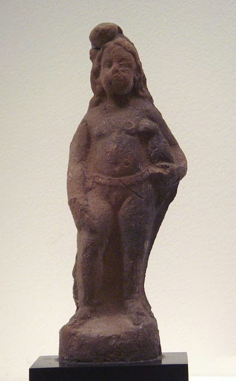
Religious objects were comparatively rare, but the site produced several significant images. A figurine associated with the Jain Tirthankara Mahavira contributed to the explanation of the name Arikamedu. Excavations also recovered Hindu images. H. D. Sankalia described the site as unusual in southern India because of the discovery of a statue of Brahma, and he noted that comparable evidence had not been found even in northern India.
The Brahma image was described as seated on a lotus, in a form compared with the representation of Brahma emerging from Vishnu's navel. A hole in the center of the lotus may have allowed the figure to be fixed to a peg representing the stalk. These finds indicate that the commercial settlement also belonged to a religious and cultural environment, although the limited number of idols does not allow a complete reconstruction of local religious life.
Structures and Material Remains
The southern sector contained an oblong brick-and-lime-mortar structure about 45 metres long. A dividing wall ran through it, and archaeologists interpreted the building as a storehouse. Its scale suggests that storage was an important part of the settlement's commercial activity.
The northern sector contained two walled enclosures with ponds and drainage arrangements. These may have supported dyeing operations. The possibility that muslin was dyed for export connects the structures with textile production, though the exact process and organization of the work remain uncertain.
Other finds include wheel-turned blackware, terracotta figurines, shell beads, gems, gold, iron nails, a copper percussion beater, an ivory handle, a wooden toy boat, and pieces of Roman lamps. The objects represent several aspects of daily life: storage, cooking, craft production, trade, personal adornment, ritual, and play.
A distinctive type of rouletted ware found at Arikamedu was initially considered non-Indian and associated with the Mediterranean. It has since been examined as “Arikamedu Type 1” within a wider scientific study of early historic networks in South Asia and beyond. Another ceramic category, “Arikamedu Type 10,” has been studied for its style and spatial distribution. These classifications show how individual sherds can contribute to larger debates about movement, manufacture, and cultural contact.
Changing Interpretations
The history of Arikamedu's interpretation is itself important. Wheeler's excavations provided a powerful connection between the site and Roman commerce. His conclusion that Arikamedu was a Yavana trading station helped establish the site as a landmark in the archaeology of Indo-Roman exchange.
Later work did not remove the evidence of Roman contact, but it changed the scale and character of the story. Begley and Raman argued that the trade connections extended from the 2nd century BCE into the 7th or 8th century CE. They also emphasized the site's bead production, local ceramics, structural weaknesses, and mixed population. In this view, Arikamedu was not simply a Roman enclave but a long-lived South Asian port whose inhabitants engaged with foreign merchants and imported goods.
The revised chronology also makes it difficult to reduce the site to the reign of Augustus or to a two-century commercial episode. Arikamedu's history includes earlier megalithic traditions, a major phase of Mediterranean exchange, later overseas connections, and objects introduced after the principal occupation through disturbance and brick-robbing.
Conservation and Modern Status
Arikamedu has been under the control of the Archaeological Survey of India since 1982. The site has been affected by the removal of ancient bricks, both in the eighteenth-century accounts and during later periods. This history of brick-robbing makes systematic excavation and conservation especially important, since structures and layers can be disturbed even when individual artifacts survive.
In October 2004, the Government of Pondicherry and the Italian Ministry of Foreign Affairs held an international conference concerning joint investigation and conservation. The ancient commercial relationship between Arikamedu and the Roman world was central to these discussions. The Government of Pondicherry decided to propose the site for UNESCO World Heritage status, while the Archaeological Survey of India proposed it under the title “Silk Road Sites in India.”
Today, Arikamedu remains an archaeological site near Puducherry rather than a continuously inhabited ancient city visible in its original form. Its significance lies in the evidence preserved beneath and around the mound: ceramics, beads, amphorae, structures, burials, religious images, and traces of a settlement that connected the southeastern coast of India to distant maritime worlds.