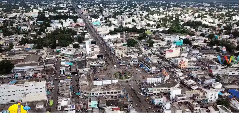
Overview
At the mouth of the Krishna’s wider maritime region, the town now called Machilipatnam developed as a port whose history reached far beyond the Andhra coast. Ancient geographical writers knew the surrounding country as Masalia or Maisolia, a region associated with cotton production and seaborne commerce. By the seventeenth century, the port—then commonly called Masulipatnam, Masulipatam, Masula or Bandar—had become the principal seaport of the Golconda Sultanate.
Its position connected the Deccan interior, the Krishna and Godavari deltas, the Bay of Bengal and the wider Indian Ocean. Cotton textiles moved outward through its harbour, while silver and other imports travelled inland toward Golconda and Hyderabad. Indian, Persian, Armenian and other Asian merchants operated there alongside the Dutch and English East India Companies. Ships associated with Masulipatnam reached Pegu in lower Burma, Aceh in Sumatra and ports near the Red Sea.
The city’s importance changed over time. Its commercial position weakened as Madras grew and as political changes disrupted the links between the coast and the Deccan. Yet Machilipatnam remained an administrative centre, a textile town and a place of political activity. In the twentieth century, it became associated with Telugu journalism, national education, Andhra political organisation and the founding of Andhra Bank. Today it remains the headquarters of Krishna district and a coastal city shaped by handloom production, fishing, local industry, religious life and recurring cyclones.
Etymology and Names
Machilipatnam has been known by several names. During the seventeenth century, Masulipatnam, Masulipatam and Masula were widely used. Bandar, another established name, comes from the Persian word for “port.” The variety of names reflects the town’s position within multilingual commercial and political networks.
The oldest names connected with the area come from classical geographical descriptions. The Periplus of the Erythraean Sea, dated to the first century CE, describes a coastal and inland region called Masalia. Ptolemy’s second-century Geography uses the form Maisolia. The ancient name Maesolia also appears in accounts of the port town and surrounding region. Modern historical interpretation places Masalia or Maisolia around the mouth of the Krishna River, including the area of present-day Machilipatnam.
These names should not be treated as identical to the modern municipal city in every ancient reference. The classical descriptions concern a wider region, and individual ports within it were separately named. Nevertheless, they show that the Krishna coast was recognised as a producing and trading zone many centuries before European companies established settlements there.
Geography and Location
Machilipatnam lies on the southeast coast of India in Andhra Pradesh, about 60 kilometres from Vijayawada. It is situated at approximately 16.17° north and 81.13° east, with an average elevation of 14 metres. Its location places it within the lower Krishna region and close to the deltaic coast that supported both agriculture and maritime exchange.
The surrounding geography helped connect inland production with overseas commerce. Cotton cloth produced in the northern Coromandel and Godavari Delta could be brought to the port, while imported silver and other goods could move inland toward the Deccan. The Krishna River and its delta formed part of a wider network of settlements and routes rather than serving simply as a local waterway.
The same low-lying coastal setting also exposed Machilipatnam to cyclones and storm surges. The city receives much of its annual rainfall from the southwest monsoon and has a tropical savanna climate, with hot summers and moderate winters. April to June are the hottest months. The normal annual rainfall of the district is given as 959 millimetres.
Severe storms have repeatedly shaped the city’s history. The cyclone of 1 November 1864 and the accompanying storm surge devastated Masulipatnam and the neighbouring coast. In 1977, a cyclone that crossed near Nizampatnam generated a storm surge of about five metres in the Krishna estuary and the coast south of the city. On 9 May 1990, another super cyclonic storm crossed the Andhra coast around 40 kilometres southwest of Machilipatnam, with estimated maximum winds of approximately 235 kilometres per hour and a storm surge of four to five metres near landfall.
The city’s exposure to the sea also influenced modern disaster preparedness. A high-capacity S-Band Doppler cyclone warning radar was installed and commissioned at Machilipatnam on 8 December 2004. The facility was intended to help monitor the state’s 960-kilometre coastline.
Ancient History
The earliest written references to the region are maritime rather than urban descriptions. The Periplus of the Erythraean Sea identifies Masalia as a place extending inland and producing large quantities of cotton cloth. This description links the Krishna coast to a specialised textile economy at a time when seaborne trade across the Bay of Bengal and Indian Ocean was expanding.
The lower Krishna was an active maritime zone during the early centuries CE. The Periplus names Kontakosylla, generally identified with Ghantasala, and another port called Allosygne within Masalia. An inscription from Ghantasala records a mahanavika, or master mariner. Classical geographical accounts also place in the same area a departure point for ships sailing across the Bay of Bengal toward Southeast Asia.
The evidence indicates a network of settlements rather than a single isolated harbour. Archaeological and epigraphic material from the Krishna delta shows that communities along the river and coast participated in wider commercial exchanges. The available evidence does not establish that every reference to Masalia meant the exact site of modern Machilipatnam, but it places the present-day city within a long-standing maritime region.
Political evidence becomes clearer in the third century CE. The Kondamudi copper plates of Jayavarman, a ruler of the Brihatphalāyana line, were issued from Kūdūra and record a grant of the village Pāṇṭūra in the district of Kūdūrāhāra. D. C. Sircar identified Kūdūra with modern Guduru near Machilipatnam, while other historians have proposed Koduru near Ghantasala. This disagreement illustrates the difficulty of matching ancient administrative names with modern places, but it confirms political activity in the lower Krishna.
Evidence directly associated with Machilipatnam becomes more substantial in the medieval period. Three inscriptions were recorded on a pillar of the Ramalinga temple in Robertsonpet and date from the twelfth century. Another inscription, dated 1397, records a private grant in a temple within the fort. These records show that the settlement contained established religious and administrative spaces by the medieval period.
Historical Timeline
Medieval Political Competition
In 1478, the army of the Bahmani ruler Muhammad Shah III reached and occupied Masulipatnam as Bahmani power expanded into the lower Krishna region. Control of the coast was not simply a local matter. The port stood in a zone where political authority over inland routes, river settlements and maritime customs could bring considerable revenue.
During the early sixteenth century, the Krishna coast lay between the competing spheres of the Gajapati Empire, the Vijayanagara Empire and the emerging Qutb Shahi state of Golconda. Vijayanagara’s ruler Krishnadevaraya campaigned in the region, capturing Kondavidu in 1515 and Kondapalli soon afterward. These campaigns brought Vijayanagara power into the Krishna delta, but the political future of the coast remained unsettled as Golconda expanded eastward.
Rise of Masulipatnam
By about 1550, Masulipatnam participated in the textile trade of the northern Coromandel coast but had not yet become its leading port. At that time, it supplied textiles to Pulicat, a larger commercial centre. The town’s position changed rapidly after about 1570.
This transformation coincided with the consolidation of the Golconda Sultanate under Ibrahim Qutb Shah and the expansion of a network of Bay of Bengal ports operating substantially outside Portuguese control. The weakening of exclusive Portuguese influence opened greater space for merchants and shipping networks that connected the eastern coast with Southeast Asia.
By the early 1580s, merchants sailing from Masulipatnam had developed substantial connections with Pegu in lower Burma and the Aceh Sultanate in Sumatra. Muslim merchants owned and operated ships from the port. They generally avoided Portuguese-controlled Malacca and sailed without Portuguese cartaz passes, or maritime permits. Masulipatnam consequently became a major node in a Bay of Bengal system linking the Deccan to Southeast Asia.
The port’s connections extended westward as well. By about 1590, ships from Masulipatnam were sailing toward the Red Sea. They carried merchandise as well as Muslim pilgrims travelling for the Hajj. The port therefore belonged to a commercial and religious geography that stretched from Southeast Asia to the western Indian Ocean.
The Golconda Port
During the seventeenth century, Masulipatnam developed into Golconda’s principal seaport. Cotton textiles from the northern Coromandel and Godavari Delta passed through the port for export. Silver and other imported goods travelled in the opposite direction, moving inland toward Golconda and Hyderabad.
Customs revenue and the textile trade contributed substantially to the prosperity of the Qutb Shahi state during the 1620s and 1630s. The port was not merely an outlet for local products; it was part of a fiscal system in which maritime commerce supported the inland state.
Its success attracted merchants from across the Indian Ocean and European chartered companies. The Dutch East India Company established itself at Masulipatnam in the early seventeenth century. The English East India Company founded a settlement there in 1611. For a time, the English settlement served as the company’s principal base on this section of the east coast. After 1640, English operations increasingly shifted toward Madras.
European companies entered commercial systems that had already been built by Indian and other Asian merchants. Indian, Persian, Armenian and other trading communities continued to operate in the port. Their presence demonstrates that Masulipatnam’s history cannot be reduced to the arrival of European companies. The companies depended on existing production, shipping, credit and trading relationships.
Commercial Reorientation and Political Change
Masulipatnam’s relative position weakened later in the seventeenth century. Commerce increasingly shifted toward Madras, while political conditions within Golconda changed. The Mughal conquest of Golconda in 1687 further disrupted the connections linking the port with the Deccan interior, although the decline had begun before the conquest.
The town nevertheless remained an important regional port into the eighteenth century. Its location and established textile economy continued to give it value, even as the balance among ports and political authorities changed.
The Siege of Masulipatam
In the eighteenth century, Masulipatnam became a contested possession during the struggles involving the Nizam of Hyderabad, the French and the British in the Northern Circars. French forces controlled the town during the Carnatic Wars. In April 1759, East India Company troops commanded by Francis Forde captured it in the Siege of Masulipatam.
On 14 May, Salabat Jung granted the Company the Circar of Masulipatam and eight associated districts, along with the Circar of Nizampatam. He also agreed to exclude French forces from his territories. The episode marked a major transition in the political history of the port. Control over Masulipatnam was now tied directly to the expanding territorial and military authority of the East India Company.
Colonial and Modern Era
Masulipatnam became an administrative centre under Company rule. At first, a chief and council administered the division from the town. In 1794, a collector responsible to the Madras Board of Revenue was appointed there. The surrounding district was known as Masulipatnam district before it was reorganised and renamed Krishna district in 1859. Masulipatnam remained the district headquarters.
The town’s commercial role declined as larger ports and railway-connected centres developed elsewhere during the colonial period. Administrative importance, however, continued. Population rose from about 36,000 in 1871 to nearly 40,000 by 1901.
A devastating cyclone interrupted this gradual colonial development. On 1 November 1864, a severe cyclone and storm surge struck Masulipatnam and the neighbouring coast. Contemporary accounts described much of the town as destroyed, and later estimates placed the death toll at approximately 30,000. The disaster severely damaged the port and became one of the most destructive cyclones recorded on the Andhra coast.
In the twentieth century, Machilipatnam gained a new kind of importance through journalism, education and political organisation. Krishna Patrika began publication in the city in 1902. Under the long editorship of Mutnuri Krishna Rao, it developed into an influential Telugu nationalist newspaper.
The Swadeshi movement encouraged the growth of national education. Local leaders including Kopalle Hanumantha Rao, Mutnuri Krishna Rao and Bhogaraju Pattabhi Sitaramayya were associated with the creation of Andhra Jateeya Kalasala. The institution combined literary and scientific education with vocational and artistic training. It became closely associated with the nationalist movement in coastal Andhra.
Machilipatnam was also the birthplace of Andhra Bank. Pattabhi Sitaramayya established the bank in the city in 1923 with financial backing from Raja Yarlagadda Sivarama Prasad. The bank began business on 28 November 1923 and later expanded across India before nationalisation in 1980.
The city remained active in the independence movement during the 1940s. On 28 July 1942, presidents and secretaries of the district Congress committees in Andhra met secretly at Machilipatnam under the chairmanship of Pattabhi Sitaramayya. The meeting preceded the circulation of the programme generally known as the Andhra Circular or Kurnool Circular for the approaching Quit India Movement.
After Congress leaders were arrested in August, students organised protests. Demonstrations and confrontations with police followed in Machilipatnam. These events place the city within the political history of the wider Andhra region, where journalism, education, local institutions and political networks reinforced one another.
Political Significance
Machilipatnam’s political importance arose from its dual identity as a port and an administrative centre. In earlier periods, control of the settlement was connected to access to the lower Krishna, the coast and the customs generated by maritime commerce. This helps explain the competition among the Bahmanis, Vijayanagara, Golconda, the Mughals, the Nizam, France and Britain.
Under Company rule, the town’s role became more explicitly bureaucratic. The appointment of a collector in 1794 and the later organisation of Krishna district gave Machilipatnam a lasting administrative function even as its position in overseas commerce diminished.
After independence, Machilipatnam remained the headquarters of Krishna district. It became part of Andhra State in 1953 and Andhra Pradesh following the reorganisation of the state in 1956. Its modern political importance is expressed through district administration, the Machilipatnam Assembly constituency and its place within the Machilipatnam Lok Sabha constituency.
The city became a municipal corporation in 2015, after having been a municipality since 1866. The Machilipatnam Urban Development Authority is headquartered there. Its contemporary public institutions reflect the transition from maritime entrepôt to district city.
Religious and Cultural Importance
Religious life in Machilipatnam includes Hindu temples, coastal pilgrimage sites and a particularly strong Shia Muslim presence. The city is described as having the largest Shia Muslim population in Andhra Pradesh. More than one hundred astanas and imambargahs are associated with Muharram rituals.
On Ashura, chest-beating ceremonies at Koneru Centre attract thousands of mourners and visitors from other religious communities. Several imambargahs are said to be more than six hundred years old, including Zari Astana, Baraimam Astana and Naqla Astana. The Baraimam Alam is carried through the streets on the night before Ashura, and the Krishna district police offer a dhati, or cloth, to the Alam.
The Chehlum Astana draws Shia Muslims from Hyderabad, Chennai, Bengaluru and Visakhapatnam for the seventeenth of Safar in the Islamic calendar. The observance associated with Hazrat Abbas’s Arbaeen attracts mourners from across South Asia. These practices give the city a religious identity closely connected with procession, mourning and shared public space.
Hindu religious sites in and around Machilipatnam include the Panduranga Temple at Chilakalapudi, the Agastheeswara Temple and Dattashram. Dattashram is a coastal pilgrimage site associated with ancient Shiva and Datta temples. Manginapudi is popularly known as “Datta Rameswaram” because twelve wells were consecrated there for bathing, recalling the wells associated with Rameswaram.
The city also forms part of a culturally rich area of Andhra Pradesh. Kuchipudi, the classical dance form, originated in the nearby village of the same name, approximately 25 kilometres from Machilipatnam. The city’s food traditions include Bandar Laddu, Bandar Halwa, almond milkshakes associated with Koneru Centre and Bandar Biryani prepared by Shia Muslims during Muharram rituals.
Economic Role
Machilipatnam’s historical economy rested on textiles, shipping and customs. The ancient Masalia region was known for cotton cloth. In the sixteenth century, Masulipatnam supplied textiles to Pulicat. By the seventeenth century, textiles from the northern Coromandel and Godavari Delta passed through the port in large quantities.
The port also served as a point of exchange between the coast and the Deccan. Silver and other imports moved inland toward Golconda and Hyderabad. This movement connected maritime commerce with the finances and consumption of the inland state.
The town’s modern handloom industry continues that textile association. Machilipatnam is known for Kalamkari textiles, produced especially in nearby Pedana. Kalamkari is a handcrafted dyed block-painting technique applied to fabric. The Machilipatnam and Srikalahasti traditions are identified as the two existing Kalamkari styles in India, and the Machilipatnam tradition has received a geographical indication from Andhra Pradesh. Its products are exported to the United States and other Asian countries.
Other local industries include boat building and fishing. The historic port was also associated with the export of diamonds, textiles and copper coins. Although the old harbour declined, the government has sought to restore the city’s port-related role. Construction of a deep seaport and associated industrial corridor under the Machilipatnam Area Development Authority began on 7 February 2019.
Monuments and Architecture
Machilipatnam’s heritage is represented by religious buildings, fort-related remains and the surviving traces of European settlement. The Ramalinga temple in Robertsonpet preserves pillar inscriptions from the twelfth century, while a temple within the fort contains an inscription dated 1397 recording a private grant. These records are especially valuable because direct evidence for the city becomes clearer in the medieval period.
The town also has ruined buildings associated with the Europeans who settled there. These remains recall the period when Dutch, English, French and Portuguese interests were connected with the port, though the commercial world they occupied had been established by Asian merchants and regional states.
Dattashram, the Panduranga Temple at Chilakalapudi and the Agastheeswara Temple remain part of the religious landscape around the city. Their significance is not limited to architecture: each belongs to networks of pilgrimage and local worship that continue to shape the region.
Famous Personalities
Machilipatnam and its surrounding area are associated with figures from politics, journalism, education, science, film, music and public life. Bhogaraju Pattabhi Sitaramayya was an independence activist and political leader who helped establish Andhra Bank and participated in the nationalist organisation of coastal Andhra. Mutnuri Krishna Rao combined journalism and political activism through his work with Krishna Patrika.
Pingali Venkayya, an independence activist associated with the city, is remembered as the designer of India’s national flag. Raghupathi Venkaiah Naidu is identified with the early development of Telugu cinema and is known as a pioneering artiste and filmmaker. C. K. Nayudu was an important Indian cricketer.
The city’s connections with Telugu cinema include actors and filmmakers such as Chitrapu Narayana Murthy, Poornima, Jagapathi Babu, C. S. R. Anjaneyulu, Nirmalamma, Achyuth and Maruthi. Music and performance figures associated with Machilipatnam include B. Vasantha, Master Venu and Mani Sharma. U. G. Krishnamurthy was a philosopher, while Turaga Desiraju was a neurophysiologist and professor at the National Institute of Mental Health and Neurosciences. Srikanth Bolla is identified as an entrepreneur and as the first Indian blind student to study at the Massachusetts Institute of Technology.
Decline and Revival
Machilipatnam’s commercial decline was relative rather than absolute. Its position weakened as Madras became more prominent, as railway-linked centres developed elsewhere and as the Mughal conquest of Golconda disrupted connections with the Deccan. The port remained regionally important into the eighteenth century and retained its administrative role under colonial rule.
Natural disasters compounded the pressures of political and commercial change. The 1864 cyclone damaged the port severely, while later storms showed that the city’s geography continued to expose it to exceptional risk. The installation of cyclone-warning radar in 2004 represents a modern attempt to respond to that long-standing environmental vulnerability.
Revival efforts have focused on both heritage and infrastructure. The survival of textile traditions, especially Kalamkari, links the modern economy with the city’s historical identity as a textile port. Plans for a deep-water port and industrial corridor similarly seek to reconnect Machilipatnam with maritime commerce, although its present role remains centred on administration, education, local industry and services.
Modern City
Machilipatnam is a municipal corporation and the administrative headquarters of Krishna district. It is also the headquarters of Machilipatnam mandal and the Machilipatnam revenue division. The corporation covers 26.67 square kilometres.
The 2011 census recorded a population of approximately 232,000, including 113,286 males and 118,714 females. The sex ratio was 1,047 females per 1,000 males. Children aged between zero and six numbered 13,778. The average literacy rate was 83.32 percent, higher than the Andhra Pradesh average recorded in the same account.
Education is provided through government, aided and private schools under the state’s School Education Department. Krishna University is located in Machilipatnam. Roads connect the city to Pune through Hyderabad, Suryapet and Vijayawada via National Highway 65, while National Highway 216 passes through the city between Kattipudi and Ongole.
Machilipatnam railway station is a B-category and Adarsh station under the Vijayawada railway division. It is the terminal station of the Vijayawada–Machilipatnam branch line, which connects with the Howrah–Chennai main line at Vijayawada. The city’s bus station is operated by the Andhra Pradesh State Road Transport Corporation and includes a depot for bus storage and maintenance. The nearest international airport is Vijayawada Airport, about 63 kilometres away.
Visitors encounter a city where several historical layers remain visible: the memory of an Indian Ocean port, ruined European buildings, religious processions, textile craft, coastal pilgrimage and the continuing threat of cyclones. Machilipatnam’s historical importance lies not in a single monument or dynasty, but in the way these maritime, political, cultural and environmental histories intersect.