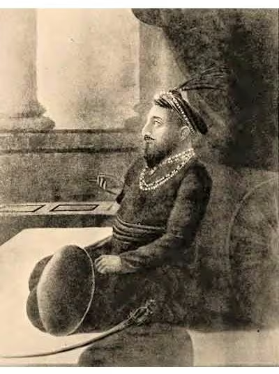
Bengal Subah and the Nawabs of Bengal, 1717–1765
Introduction
Murshidabad’s position near the centre of Bengal, Bihar, and Orissa explains the political logic of the Nawabs of Bengal: a provincial government that operated across a large eastern Indian zone while retaining a formal connection to the Mughal court in Delhi. From 1717, when Mughal emperor Farrukhsiyar recognised Murshid Quli Khan as hereditary Nawab Nazim, the nawabs governed with increasing independence. They continued to issue coins in the Mughal emperor’s name, but in practical terms they exercised the powers of independent monarchs.
This map presents the Bengal Subah during the period when its authority was both expansive and increasingly contested. Its broad jurisdiction ran from the border with Oudh in the west to the border with Arakan in the east, and included Bengal, Bihar, and Orissa. The political territory contained manufacturing cities, inland commercial centres, coastal ports, European trading settlements, military fortifications, and regions where local zamindars or invading powers challenged the nawab’s authority.
The map’s central chronological frame begins with Murshid Quli Khan’s recognition in 1717 and ends in 1765, when Robert Clive received the Diwani of Bengal from Mughal emperor Shah Alam II on behalf of the East India Company. Between these dates, the province reached its height under Shuja-ud-Din Muhammad Khan, endured Afghan and Maratha attacks under Alivardi Khan, and lost its independent political position after the battles of Plassey in 1757 and Buxar in 1764.
Historical Context
The Bengal Subah had been incorporated into the Mughal administrative system after Akbar’s conquest in the sixteenth century. Two major branches of provincial government shaped its administration: the nizamat, concerned with executive and military authority, and the diwani, associated with revenue and legal affairs. The subahdar or viceroy formally headed the province, while the diwan served as the principal revenue official.
The weakening of Mughal central power allowed provincial officeholders to consolidate authority. A major conflict developed between Azim-us-Shan, the Mughal viceroy of Bengal, and his prime minister Murshid Quli Khan. In 1703, Aurangzeb transferred Azim-us-Shan from Bengal to Bihar. After the viceroy’s departure, Murshid Quli Khan emerged as the effective ruler. His administrative coup combined the offices of diwan and subedar, concentrating provincial power in one authority.
Murshid Quli Khan moved the capital from Dhaka in 1716 to a new city named Murshidabad after him. In 1717, Farrukhsiyar recognised him as the hereditary Nawab Nazim. The new capital was not simply a royal residence. It was the centre of revenue collection, political decision-making, banking, military administration, and court culture for the three-province territory.
The Bengal Subah reached its peak during the reign of Shuja-ud-Din Muhammad Khan. His government oversaw a period of political and economic consolidation. He developed Murshidabad’s royal palace, military base, city gates, revenue office, public audience hall, and mosques within the extensive Farrabagh compound, known as the Garden of Joy.
The succession of Sarfaraz Khan brought renewed military instability. Sarfaraz was killed at the Battle of Giria by his deputy Alivardi Khan, whose coup established a new ruling dynasty. Alivardi’s sixteen-year reign was dominated by warfare, particularly against the Maratha Empire. By the end of his rule, he turned toward rebuilding and restoring Bengal after years of invasion.
The chronology shown on the map therefore moves through three broad phases:
- 1717–1740: consolidation of hereditary nawabi rule under Murshid Quli Khan and his successors.
- 1740–1756: military pressure from Afghan insurgents and Maratha forces during Alivardi Khan’s reign.
- 1756–1765: British intervention, the fall of Siraj-ud-Daulah, the installation and removal of rival nawabs, and the transfer of the Diwani to the East India Company.
Territorial Extent and Boundaries
The Nawab’s formal jurisdiction covered the three provinces of Bengal, Bihar, and Orissa. The territory extended westward to the border with Oudh and eastward to the border with Arakan. This was a large and varied political space rather than a uniformly administered block. The nawab’s authority was strongest around the capital and major administrative centres, while zamindars and frontier officials exercised substantial local power.
The map therefore represents the nawab’s territory as a broad political sphere rather than as a boundary fixed with modern precision. The surviving record identifies the western and eastern limits, but it does not establish a single uniform line for every district throughout the eighteenth century. Authority shifted with military campaigns, revenue arrangements, local rebellions, and the activities of European companies.
Bengal formed the political and economic core. Murshidabad stood at the centre of the administration, while Dhaka retained major importance in eastern Bengal. Bihar extended the nawab’s authority toward the Mughal heartlands and contained the important centre of Patna. Orissa connected the provincial territory to the Bay of Bengal and to maritime trading networks, including Dutch and Austrian settlements.
The eastern side of the map reaches toward Arakan and the northeastern Bay of Bengal. Bengal’s military forces were credited with superiority over Arakan and Tripura in artillery. Mughal authorities also built or maintained fortifications in the region, including Idrakpur Fort, Sonakanda Fort, Hajiganj Fort, Lalbagh Fort, and Jangalbari Fort. These strongholds indicate the importance of protecting riverine routes, settlements, and the northeastern approaches.
The political geography also included areas where the nawab’s authority was nominal or contested. Bihar’s zamindars maintained a tenuous loyalty. Rebellion and withholding revenue were common, and records indicate that the nawabs struggled to extract substantial revenue from Bihar’s chiefs until 1748. Even afterward, the amounts obtained remained low because the zamindars were frequently in arms.
Orissa experienced an especially significant change during the Maratha invasions. The raids continued from 1741 to early 1751, and the expeditions led by Raghuji Bhonsle of Nagpur established de facto Maratha control over Orissa. The province was formally incorporated into the Maratha Empire in 1752. The map should therefore distinguish between the nawab’s wider claim over the three provinces and the changing reality of control in Orissa.
Administrative Structure
The Nawabs of Bengal inherited the institutional framework of Mughal provincial government but made it increasingly autonomous. The merger of the diwani and subedari under Murshid Quli Khan gave the nawab control over revenue, executive administration, and military affairs. This arrangement allowed the ruler to govern without depending entirely on a separate Mughal viceroy.
The capital at Murshidabad housed the main political institutions. The nawab’s palace, military base, revenue office, public audience hall, city gates, and mosques formed an administrative and ceremonial complex. Murshidabad’s central position within Bengal, Bihar, and Orissa helped connect the government to the province’s principal regions.
Dhaka remained important even after the capital moved. The Naib Nazim of Dhaka, the chief deputy of the nawab, governed much of eastern Bengal. The office combined regional authority with considerable personal wealth. Dhaka’s continued importance also derived from its role in muslin production and commerce.
Other officials were stationed in Patna, Cuttack, and Chittagong. These centres represented the administrative reach of the nawab across Bihar, Orissa, and eastern Bengal. The government also depended on zamindars, who collected revenue and exercised authority in their local areas. Their relationship with the nawab was frequently tense because local chiefs could resist assessment, delay payments, or take up arms.
Finance connected provincial administration with the wider Mughal political system. Bengal continued to contribute the largest share of funds to the imperial treasury in Delhi. The Jagat Seth family of bankers and moneylenders played a major role in controlling the flow of Bengali revenue into the imperial treasury. They financed the nawabs as well as European companies operating in the region, making banking an important element of the political map.
The administrative structure thus combined centralised nawabi authority, Mughal titles and institutions, local zamindari power, regional deputyships, and financial dependence on bankers. This combination explains why the nawabs could act independently while still maintaining formal links with the Mughal emperor.
Infrastructure and Communications
The available record emphasises commercial and military connections more than a named road or postal system. Bengal’s infrastructure was built around cities, riverine movement, fortified sites, manufacturing centres, caravanserais, and maritime routes through the Bay of Bengal.
Murshidabad’s Katra Masjid served as a caravanserai where traders from across Eurasia could be lodged. Dhaka contained the Bara Katra and Choto Katra, which similarly connected commercial activity with urban hospitality and movement. These establishments demonstrate the importance of organised accommodation for merchants, agents, workers, and travelling officials.
The province’s maritime infrastructure was particularly significant. Bengal was notable for shipbuilding, especially in Chittagong, where Ottoman and European demand supported production. The Bay of Bengal linked the nawab’s territory to wider commercial circuits and brought European companies into direct contact with Bengali producers and officials.
The region’s military infrastructure included forts at Idrakpur, Sonakanda, Hajiganj, Lalbagh, and Jangalbari. These fortified locations represented the state’s effort to protect strategic settlements and approaches. Bengal also possessed a navy and a long shipbuilding tradition. Its forces were credited with expelling Arakanese and Portuguese pirates from the northeastern coastline of the Bay of Bengal.
The map’s trade and communications layer should therefore be read as a network of connected centres rather than as a single engineered road system. Murshidabad connected administration and finance; Dhaka connected eastern Bengal to the muslin trade; Patna linked Bihar’s industrial and military production to the wider province; and Chittagong, Hugli, Balasore, and Pipeli connected inland production to maritime commerce.
Economic Geography
Nawabi Bengal presided over a period of proto-industrial growth. The Bengal-Bihar-Orissa triangle produced cotton muslin, silk cloth, ships, gunpowder, saltpetre, and metal goods. Production was distributed across several urban and regional centres, creating an economic geography that extended beyond the capital.
Dhaka and Sonargaon were the principal centres of the muslin trade. The worldwide demand for Bengal muslin generated revenue for the nawabs and employment for weavers and associated workers. Murshidabad was a major centre of silk production. Patna was associated with metalwork and the military-industrial economy, as well as the production and export of gunpowder and saltpetre.
Shipbuilding at Chittagong responded to Ottoman and European demand. The port’s position on the Bay of Bengal made it significant both for commerce and for naval activity. Orissa contained several important trading sites. Pipeli was the principal Dutch port in Orissa, while Balasore became a prominent Austrian trading post.
The European presence was extensive. The British East India Company, French East India Company, Danish East India Company, Austrian East India Company, Ostend Company, and Dutch East India Company all established bases or trading posts in the region. Dutch settlements included Pipeli, Rajshahi, Cossimbazar, and Hugli. The Danish established trading posts in Bankipur and on islands in the Bay of Bengal.
Commercial activity depended on more than merchants alone. Bengali cities contained brokers, workers, peons, naibs, wakils, and ordinary traders. These groups handled production, credit, contracts, transport, administration, and communication between local producers, nawabi officials, bankers, and foreign companies.
The nawabs’ financial strength also rested on the relationship between manufacturing and revenue. Bengal was the wealthiest subah of the Mughal Empire and supplied a large share of the imperial treasury. The Jagat Seth bankers served as financiers to both the provincial government and European companies. This financial system made Bengal economically powerful, but it also made control of the province highly attractive to the East India Company.
Cultural and Religious Geography
Murshidabad was a centre of court culture under the nawabs. The rulers patronised the Murshidabad style of Mughal painting, Hindustani classical music, the Baul tradition, and local craftsmanship. The city’s palaces, audience halls, mosques, gates, and gardens expressed the relationship between political authority, artistic production, and religious architecture.
The capital’s Farrabagh complex, developed under Shuja-ud-Din Muhammad Khan, included royal and administrative buildings, mosques, canals, fountains, flowers, and fruit trees. It represented the nawab’s effort to shape Murshidabad as a formal court city and a visible centre of authority.
The cultural geography of the territory was not limited to the capital. Dhaka and Sonargaon supported the textile economy that sustained thousands of artisans and workers. Patna’s metalworking and military production created its own urban culture of skilled manufacture. Ports and trading settlements brought Bengali merchants and artisans into contact with European, Ottoman, and other Eurasian commercial interests.
The record also identifies the Baul tradition and Hindustani classical music among the cultural forms patronised during the period. It does not establish a uniform religious or linguistic boundary across Bengal, Bihar, and Orissa. The map should therefore avoid presenting culture as a set of rigid provincial divisions. Court culture, local craftsmanship, commercial communities, and regional traditions overlapped across the nawab’s territory.
Military Geography
Military geography shaped the nawab’s history at every stage. The province possessed good artillery, a notable navy, and a major shipbuilding tradition. Fortifications protected important locations, while military campaigns exposed the limits of central authority in frontier and zamindari regions.
The Afghan insurrections between 1745 and 1750 were a series of four revolts led by Afghans living in the Bengal Subah. Mustafa Khan, Sardar Khan, and Shamshir Khan sought to carve out an Afghan state in Bengal. The revolts were ultimately suppressed, but they added to the pressure on the nawab’s administration.
The Maratha invasions were more destructive and lasted for roughly a decade, from 1741 to early 1751. The principal engagements included the First and Second Battles of Katwa, the Battle of Burdwan, the Battle of Rani Sarai, the Battle of Birbhum, and the First and Second Battles of Midnapur. Alivardi Khan defeated the Marathas and repelled their attacks in several confrontations, but the raids caused severe disruption.
The Maratha expeditions led by Raghuji Bhonsle also established control over Orissa. Alivardi Khan eventually agreed to pay an annual tribute of Rs. 1.2 million as the chauth of Bengal and Bihar in exchange for an end to further invasions. This agreement illustrates the difference between formal jurisdiction and effective power: the nawab retained a claim over the wider province while conceding financial and territorial advantages to the Marathas.
In 1756, Siraj-ud-Daulah turned against the British presence. On 20 June, his forces besieged and captured Calcutta, overrunning Fort William and temporarily expelling the East India Company. The company responded by sending a fleet under Robert Clive. By January 1757, the British had retaken Fort William.
The decisive shift came at Plassey on 23 June 1757. Siraj-ud-Daulah and his French allies were caught off guard after the defection of the nawab’s commander-in-chief, Mir Jafar, to the British side. The battle ended the independent authority of the Nawabs of Bengal. Siraj-ud-Daulah was arrested and killed by former officers, and Mir Jafar was installed as a British-backed ruler.
The struggle continued under Mir Qasim. He ceded Chittagong, Burdwan, and Midnapore to the East India Company but later attempted to build an independent army and resist British control. He moved his capital to Munger, attacked British positions at Patna, overran company offices, and killed the company’s resident. Mir Qasim allied with Shuja-ud-Daula of Awadh and Mughal emperor Shah Alam II, but the coalition was defeated at Buxar in 1764.
Buxar was the last major opportunity to resist British expansion across northern India through a combined Bengal, Awadh, and Mughal alliance. The battle transformed the political meaning of the map: control of Bengal was no longer only a contest between a nawab and a European company, but part of a wider struggle over the Mughal successor states.
Political Geography
The Nawabs of Bengal maintained a complicated relationship with the Mughal emperor. They governed independently but continued to issue coins in the emperor’s name. Bengal’s revenue remained important to the imperial treasury, and the formal recognition of the hereditary nawab preserved a connection with Mughal legitimacy.
Relations with neighbouring powers were more unstable. The western frontier bordered Oudh, while the eastern frontier approached Arakan. The Maratha Empire became the most persistent military challenger during Alivardi Khan’s reign and gained effective control of Orissa. The Afghan insurrections represented another internal and regional challenge.
European companies formed a second layer of political geography. Their factories and trading posts were commercial establishments, but the companies also possessed armed forces, fleets, diplomatic agents, and financial resources. The British presence at Calcutta became especially significant after the siege of 1756 and the recapture of Fort William.
The French company’s cooperation with Siraj-ud-Daulah increased British suspicion during the Seven Years’ War. The contest between Britain and France therefore intensified an existing conflict between the nawab and the East India Company. After Plassey, British influence became decisive. Mir Jafar and Mir Qasim were not simply successive administrators; their appointments revealed the company’s ability to determine the political leadership of Bengal.
Legacy and Decline
The independent authority of the nawabs ended at Plassey in 1757, but the transition to direct British rule unfolded over several stages. Mir Jafar was installed as a British-backed nawab, replaced by Mir Qasim in 1760, and restored in 1763 after Mir Qasim’s resistance. The defeat of Mir Qasim, Shuja-ud-Daula, and Shah Alam II at Buxar in 1764 destroyed the strongest remaining coalition against British expansion.
In 1765, Robert Clive received the Diwani of Bengal from Shah Alam II on behalf of the East India Company. A system of dual governance followed: the nawab retained responsibility for the Nizamat, while the company controlled the Diwani. In 1772, Governor-General Warren Hastings shifted administrative and judicial offices from Murshidabad to Calcutta, the capital of the newly formed Bengal Presidency and the de facto capital of British India.
By 1793, the Mughal emperor had ceded the Nizamat of Bengal to the company, reducing the nawab to a titular figure and pensioner. After the end of company rule in 1858, the British Crown assumed direct control over territories governed by the company. The symbolic Mughal authority was abolished, and the nawabs no longer possessed political control.
The later Nawabs of Murshidabad retained wealth and status without territorial sovereignty. Hazarduari Palace was built in the 1830s as a residence of the nawabs and was also used by British colonial officials. In 1880, the title of Nawab of Bengal was abolished, while the descendants of the ruling family were recognised as nawabs of Murshidabad with the status of a peerage.
The map’s lasting significance lies in the relationship it reveals between territory, commerce, and political power. Bengal’s wealth supported the Mughal treasury, financed nawabi government, attracted European companies, and ultimately made the province the foundation of British expansion in India. The geography of Murshidabad, Dhaka, Patna, Chittagong, Orissa’s ports, and the battlefields of Plassey and Buxar records the transformation from Mughal provincial autonomy to company rule.